The proposed Sites Reservoir would be a new off-stream storage reservoir covering 12,000 -14,000 surface acres with 1.8 million acre-ft of storage capacity on the west side of the Sacramento Valley (Figure 1). The project would capture and store unregulated Sacramento River winter-spring runoff and some water previously stored in Shasta Reservoir. The diversion capacity to the reservoir would be 5400-6500 cfs, supplied by two existing river diversions (up to 1800 cfs at Red Bluff; up to 2100 cfs at Hamilton City) and a new diversion near Colusa (proponents are evaluating alternative capacities of 1500 and 3000 cfs, in addition to the currently preferred capacity of 2000 cfs). The Sites Authority webpage estimates that it could have diverted over 1 Million acre-ft to storage in Sites in 2018 and 1.8 Million acre-ft to storage in 2017; these figures assume bypass flow requirements at the diversion points and at Freeport, and sufficient storage capacity in the reservoir. The Draft Environmental Impact Report/Environmental Impact Statement (DEIR/DEIS) for the Sites Reservoir Project estimates the average annual diversion to Sites storage at about 500,000 acre-ft; actual diversions would vary depending on hydrology and regulatory constraints.
As an off-stream storage reservoir, Sites would store water behind a dam that is not on a major waterway. Water diverted to the reservoir would be pumped into canals from the Sacramento River, and then pumped into the storage reservoir from small holding reservoirs on the canals. The two existing diversions that would fill Sites have modern fish screening facilities. As currently envisioned, a pump-back hydroelectric operation would allow partial recovery of pumping costs.
The Sites project has potential benefits for fish, but also the potential to worsen conditions for fish.
Potential Benefits for Fish
- Under current operations, existing irrigation diversions on the Sacramento River draw water primarily in spring and summer via several major canal systems on the west side of the Sacramento Valley. These diversions draw mainly on water that was previously stored in Shasta Reservoir and released to the Sacramento River in part to keep river water temperatures cool. Shasta Reservoir’s cold-water pool varies in volume depending on storage and other factors, and can run out if it is not managed carefully. If the cold-water pool is depleted at the end of the summer, this threatens the viability of winter-run salmon. Under current operations, spring and summer irrigation diversions from the Sacramento River also cut flow and raise water temperatures in the lower river, which harms salmon, steelhead and sturgeon. Water diverted to storage in Sites in the winter could substitute for some of the spring and summer irrigation deliveries that currently come from Shasta. A greater percentage of water released from Shasta in spring and summer could then flow all the way to the Delta. More water could also be retained in Shasta Reservoir to protect the Shasta cold-water pool into the fall and as carryover for the following year.
- If more water were delivered to the Delta from Shasta Reservoir in the spring and summer, less water would theoretically be needed from Folsom and Oroville reservoirs to meet Delta water quality, outflow and other requirements. This could allow more targeted releases of water into the lower American and lower Feather rivers to protect fish in those waters. It could also allow better maintenance of cold-water pools and greater carryover storage in Folsom and Oroville, also very important for the respective fisheries downstream.
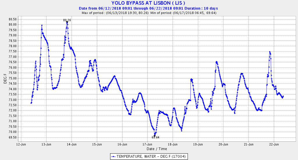
- Water stored in Sites could be delivered directly to the Delta via the Colusa Basin Drain (CBD) system and Yolo Bypass, reducing outflow demands from other Valley reservoirs. Water delivered directly to the Delta from Sites would be of higher potential productivity and could stimulate winter-spring Bay-Delta plankton blooms that would benefit Delta native fishes.
Potential to Worsen Conditions for Fish
- The proposal includes a new point of diversion on the Sacramento River with a capacity to divert 2000 cfs. This would give the project higher diversion capacity and the capability of diverting tributary runoff that would otherwise be unavailable to the two upper river diversions that now enters the Delta. This diversion would also affect flows and water temperatures in the lower Sacramento River, and subject migrating juvenile salmon, sturgeon, and steelhead to a third large screening facility. The new point of diversion would be particularly problematic if it diverted water outside the peak runoff season (late fall through spring).
- The new diversion and the reoperation of canal intakes at Red Bluff and Hamilton City to divert water in winter would compete for water with Delta diversions and would affect Delta outflow to the Bay.
- Water deliveries and hydropower releases from Sites Reservoir to the lower river at the new diversion site could affect water quality in the lower Sacramento River.
- With available winter off-stream storage, the existing diversions at Red Bluff and Hamilton City would be capable of diverting uncontrolled flows from tributaries that have otherwise remained relatively untouched down to the Delta.
- The greater diversion capacity may increase demands on Shasta storage and will increase diversion of uncontrolled tributary flows, further compromising fishes in the Sacramento River and the Bay-Delta.
- A small but potentially significant amount of water supply stored in Sites Reservoir would be lost to evaporation and groundwater seepage.
Above all, there is too much unknown to evaluate how Sites would affect fish.
As is the case for most proposed water supply projects, the project description in the draft DEIR/DEIS for Sites describes several potential configurations of project infrastructure and a description of proposed constraints. The DEIR/DEIS does not evaluate different constraints, such as different bypass flow requirements past each point of diversion; the DEIR/DEIS only evaluates one value for each point. In spite of numerous requests that the DEIR/DEIS evaluate project diversions with more stringent Delta flow and water quality requirements than the existing inadequate ones, the DEIR/DEIS only evaluates project yield with existing Delta constraints.
The benefit side is even more vague and conceptual. The entire construct of hypothetical Sites benefits would in fact require a new type of proscriptive rules and enforcement mechanisms that would be unprecedented for California water projects. There is simply no clue in any of the Sites literature what those rules would be or even could be.
The project description places no numbers on how much water stored in Sites the project’s operators would dedicate to actions designed to benefit fish. The project description defines no decision-making process for dedicating water to fish, other than to say that on an overarching basis fish agencies will decide. The project description defines no way in which project operators will apportion water for fish against water for water supply. For all the offsets that seem to comprise the lion’s share of fish benefits, the project description does not say how water from Sites will generate improvements in operation of state or federal reservoirs, or whether it will be Sites operators or state and federal operators who make the calls.
Then there is the question of whether there would be any offsets at all. There is no assurance that there will be any decreases at all in water use from Shasta or from other state and federal reservoirs. Water freed up by using Sites to meet Sacramento Valley water supply could simply allow Sac Valley water users to irrigate more land or sell more water for export at the Delta pumps. The DEIR/DEIS proposes no mechanism of enforcing offsets: who would regulate the project’s use of water, who would manage the interaction between Sites water and water from Shasta, Oroville, Folsom and perhaps Trinity reservoirs, and how and against whom any requirements would be enforced.
There are other problems. A shift to winter-spring diversions and use of canal systems would potentially change groundwater recharge and use patterns in the Sacramento Valley. The project would compete for water available to the proposed WaterFix Twin Tunnels project in the Delta. Sites and WaterFix have their “sights” on the heretofore untouched tributary inflows that are also protected by Delta export OMR limits so the flows reach the Bay. There will be a big fight over this uncontrolled water that now makes up a significant portion of the Bay’s freshwater input in drier years. Both projects have claimed future benefits of the same pot of water.
Conclusion
There are potential benefits from Sites project’s main features to Central Valley fishes, including salmon, steelhead, sturgeon, smelt, and striped bass. Most of the benefits would result from switching the diversion time period of the two existing upper river diversions and Shasta reservoir releases to these diversions. The added new diversion and increase in winter diversions will at important times reduce Sacramento River flow and Bay-Delta inflow and outflow, harming fish in certain but sometimes hard to quantify amounts.
Past water developments in the Central Valley have overwhelmingly made conditions for fish worse. The Sites project proponents claim that their project will be different. These proponents have not done themselves, the public, or public policy any favors by relying on generalities and politics as the centerpieces of their efforts to advance their project. At this time, there are too many unknowns to meaningfully evaluate the possibility that benefits might outweigh the harm and justify the costs. In the meantime, it is a reasonable working presumption that the Sites project will worsen conditions for fish as well.
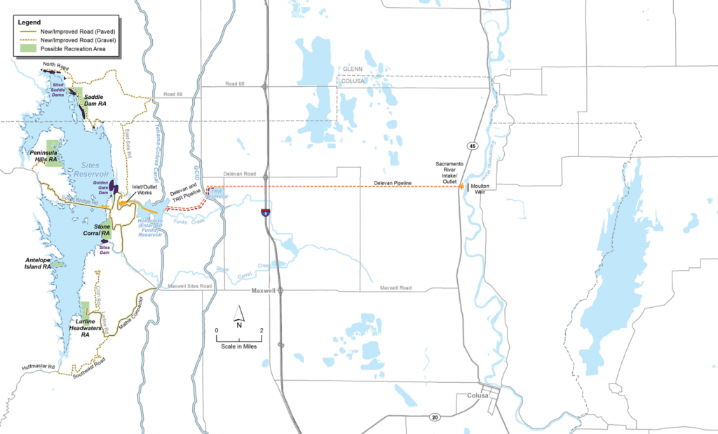
- Figure 1. Proposed Sites Reservoir and associated infrastructure on west side of the Sacramento Valley.