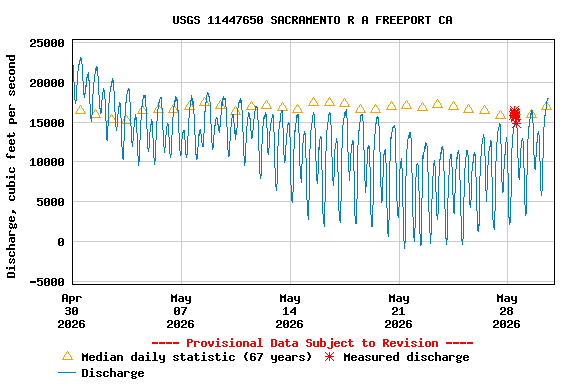
Water year 2026 is an average or normal year in terms of total precipitation, similar to 2024 and 2025 (Figure 1).
On April 29, 2026, the Bureau of Reclamation sent a Draft Sacramento River Temperature Management Plan (TMP) to the State Water Resources Control Board (State Board) for review. The Draft TMP stated that it would manage Shasta Reservoir (near Redding) in 2026 according to a drier-year standard than the amount of actual storage in Shasta Reservoir required on paper. The requirement is given in the National Marine Fisheries Service’s 2024 Biological Opinion for the Long-Term Operation of the Central Valley Project and State Water Project (LTO).
Reclamation explained that it based its classification of 2026 on the “Action 5” Operations Plan for the LTO. Action 5 is Reclamation’s modification of the 2024 LTO Biological Opinion. Reclamation adopted Action 5 in December 2025 to comply with a January 2025 presidential order to increase water deliveries.
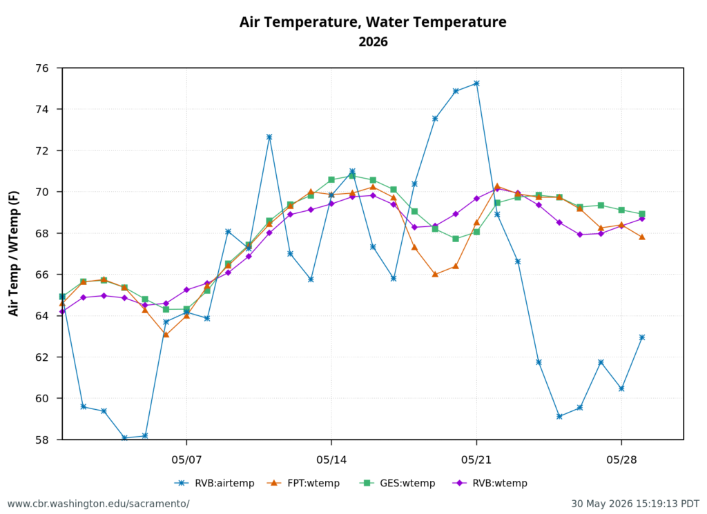
The Draft TMP also proposed locations on the Sacramento River where Reclamation would meet water temperatures to support spawning and egg incubation of winter-run Chinook salmon. June is the peak spawning season for winter-run salmon below Shasta Dam.
The State Board responded to Reclamation on May 15, 2026 with a comment letter on the Draft TMP. The State Board’s comments requested additional analyses, including reduced deliveries and increased end-of-September storage in Shasta Reservoir. On June 1, 2026, Reclamation issued a Final TMP whose proposed operations were functionally the same as those that Reclamation proposed in the Draft TMP.
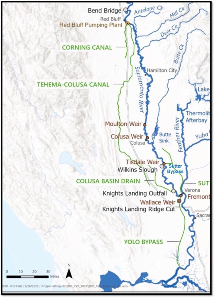
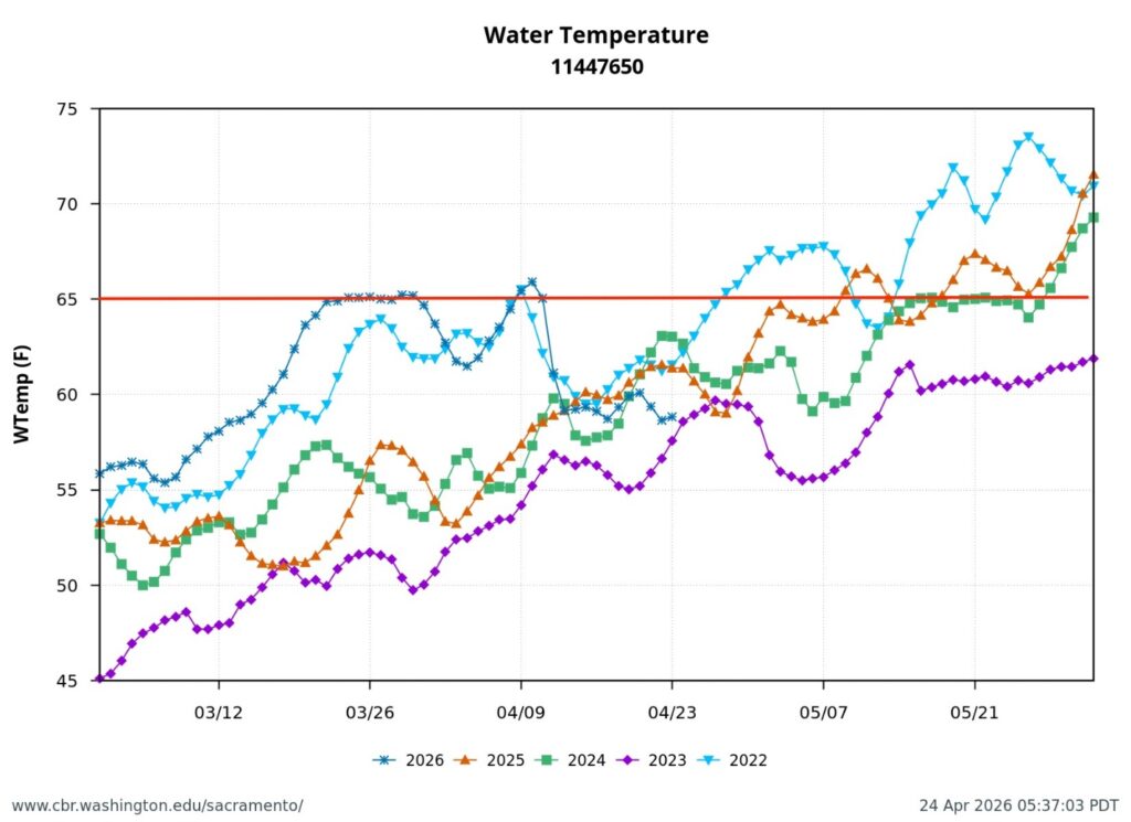
On June 10, 2026, the Executive Director of the State Board sent a response to the Final TMP to Reclamation “objecting to the final TMP as per the language in Water Rights Order 90-5.” However, the Executive Director’s response does not specify any specific actions the State Board will take against Reclamation. Instead, it requires Reclamation to meet 53.5ºF in the Sacramento River at Clear Creek (River Mile or RM 290) through the summer and to report to the State Board when water temperatures do not meet 56ºF at Balls Ferry (RM 276). 53.5ºF in the Sacramento River at its confluence with Clear Creek provides about ten miles of river with water cold enough for salmon eggs.
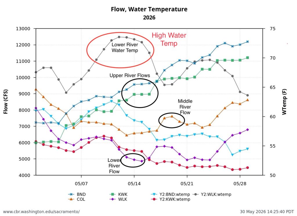
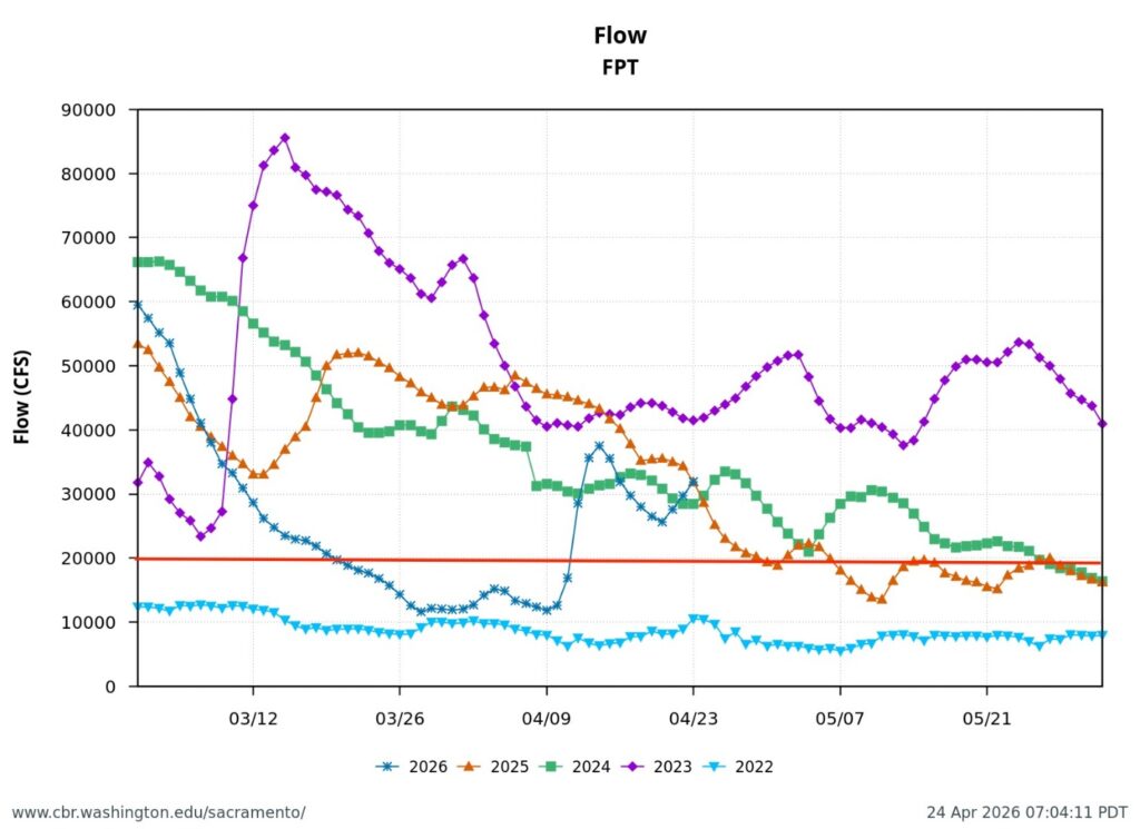
In June 2026, Reclamation released water from Shasta Reservoir to maintain Sacramento River temperatures at 56ºF at Bend Bridge (RM 258). Also in June, Reclamation released enough water to deliver approximately 6000 cubic feet per second (cfs) of water to its contractors along the Sacramento River (Figure 2).
The State Board’s main problem with Reclamation’s TMP is the high amount of Shasta releases (approximately 12,000 cfs, or 24,000 acre-feet per day) to meet both the temperature standards and contractor demands. Those releases are expected to increase in July. In combination, this level of release could deplete Shasta’s cold-water pool before the end of the salmon spawning and incubation season.
The Board is concerned because prior-year TMPs failed to maintain Shasta’s cold-water pool through the salmon spawning seasons (Figure 3 and 4). Spawning success of fall-run salmon and winter-run salmon was compromised in past years with relatively average precipitation.
The challenge is to make sure there’s enough water for all uses through autumn. The State Board wants a plan that targets 2.4 million acre-feet of storage in Shasta Reservoir at the end of September, as shown in Figure 5. This is the amount shown on paper in the Biological Opinion that governs Shasta Reservoir. It is unclear how, even with Reclamation’s “Action 5” modification of the Biological Opinion, Reclamation arrived at its proposed lower end-of-September storage level.
Achievement of end-of-September Shasta storage of 2.4 million acre-feet could mean cutting back on scheduled water deliveries or finding a balance with river flows and water temperature goals.
Other possibilities to reduce summer and autumn water temperatures in the Sacramento River include adjusting the timing and volume of water Reclamation imports from the Trinity River to the Sacramento River through Whiskeytown Reservoir. They also include modifying Reclamation’s hydropower operations at Shasta Dam; Reclamation’s turbines sometimes draw water from relatively warm parts of Shasta Reservoir.
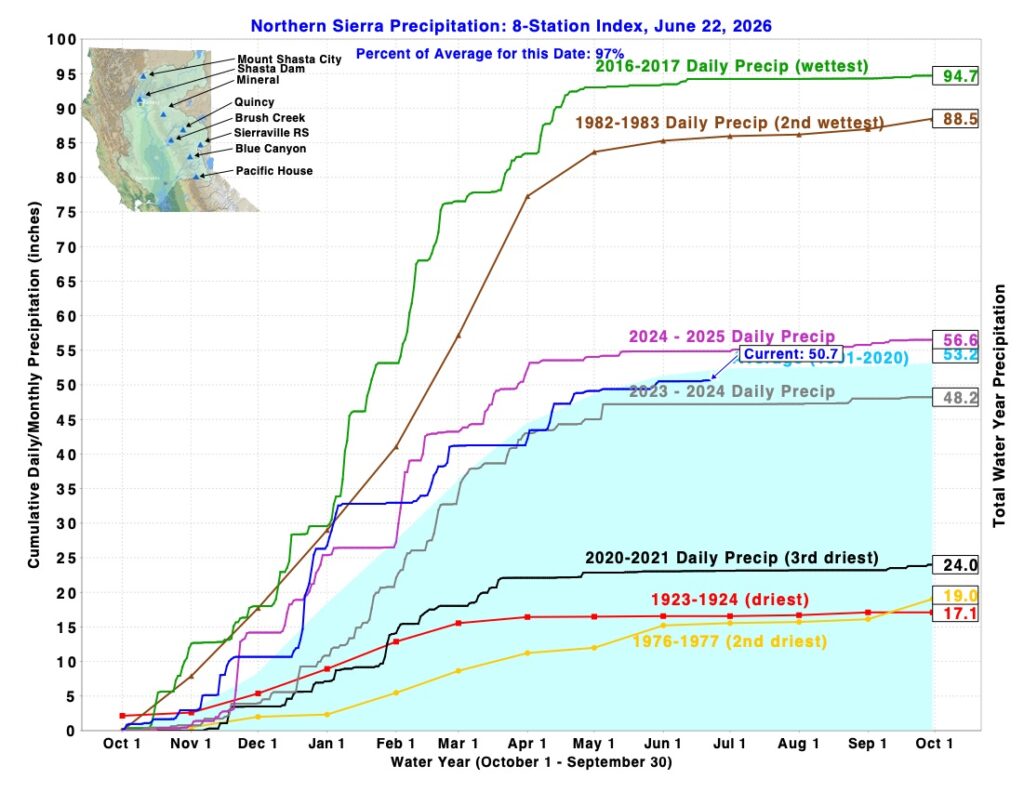
Figure 1. Eight-River Index in June 2026 compared to past years. Source: CDEC.
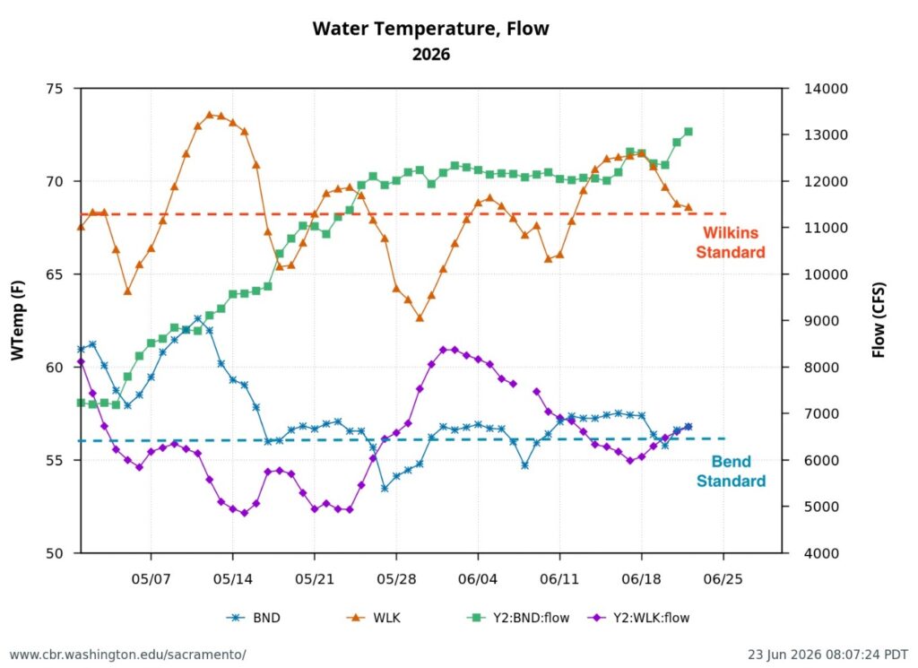
Figure 2. From May 1 through mid-June 2026, Reclamation did not meet water temperature standards in the upper Sacramento River at the Bend Bridge (BND) or in the lower Sacramento River below Wilkins Slough (WLK). In mid-May and mid-June, Reclamation was delivering about 6000 cfs to contractors from the Sacramento River upstream of Wilkins Slough.
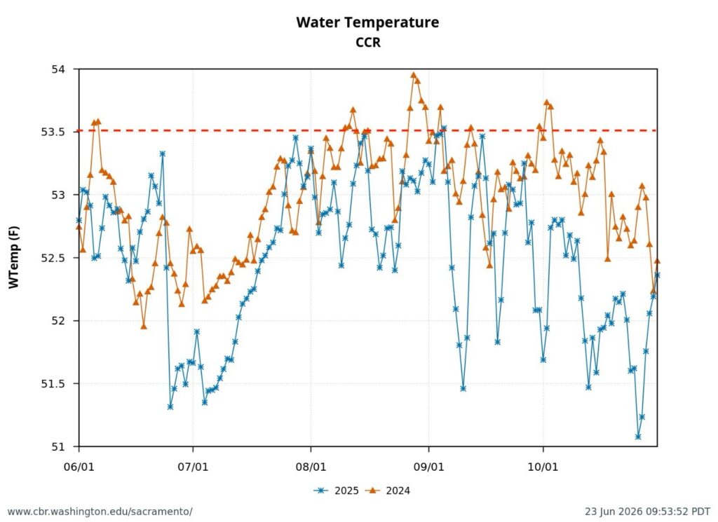
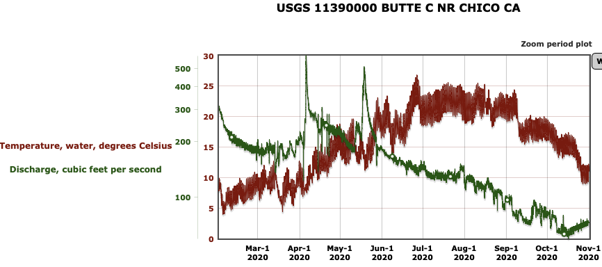
Figure 3. Sacramento River water temperature at Clear Creek gage near Redding June through October 2024 and 2025. Dotted red line is water temperature target of temperature management plans in 2024 and 2025.
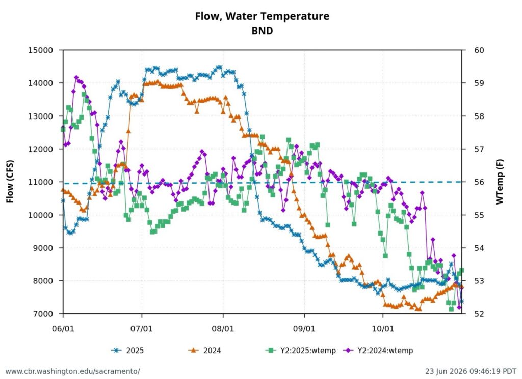
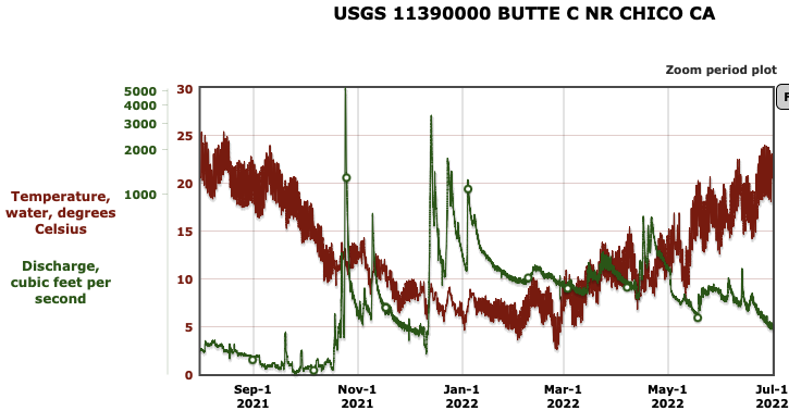
Figure 4. Sacramento River water temperature and streamflow at Bend Bridge gage near Red Bluff June through October 2024 and 2025. Dotted blue line is water quality standard and permit requirement for water temperature. Note general lack of compliance in June, August, and September of both years. Note also drops in flow from14,000 to 8,000 cfs over the summer can lead to winter run salmon redd dewatering and winter-run egg and alevin mortality.
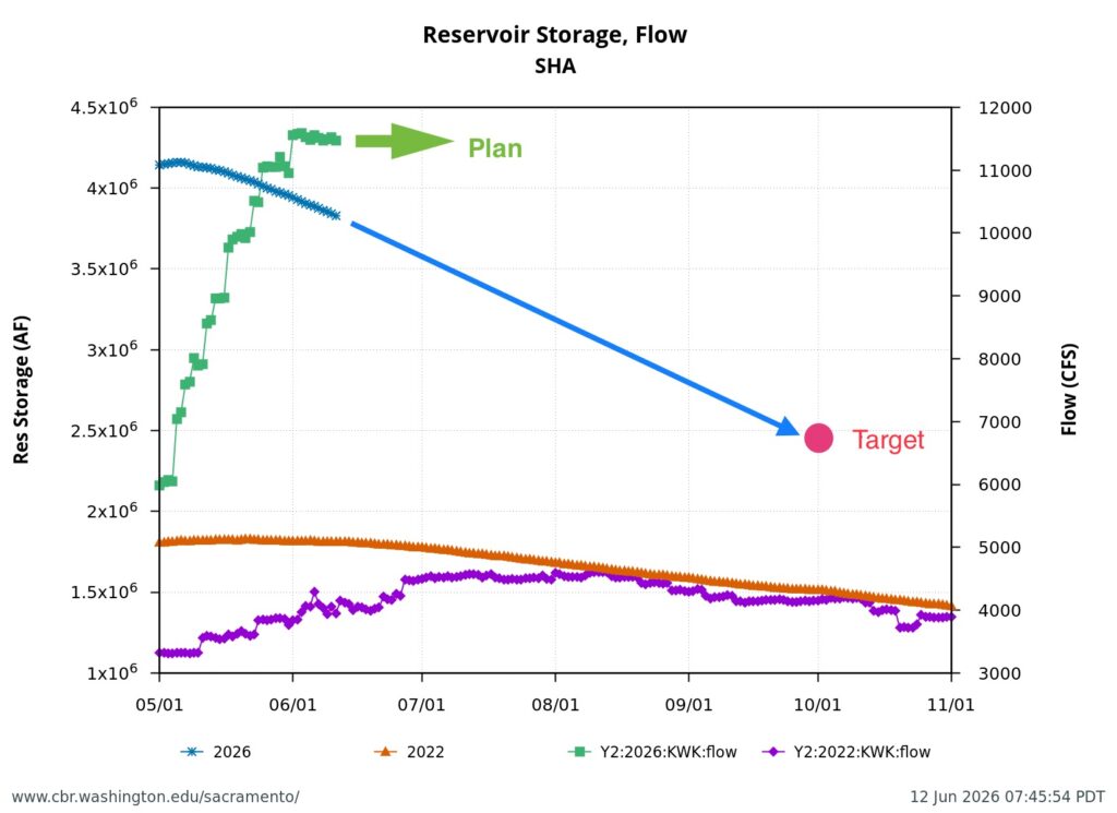
Figure 5. Shasta Reservoir water storage and releases in drought year 2022 and average year 2026. The State Board wants a Temperature Management Plan from Reclamation that meets a target end-of-September storage of 2.4 million acre-feet.