On July 1, 2021, staff from the State Water Resources Control Board (State Board) held a public Zoom meeting to provide information and solicit input on potential actions that could be implemented to address low flows in the Scott River and Shasta River watersheds (Figure 1) during the ongoing drought. The Scott and Shasta rivers are major salmon and steelhead producing tributaries of the Klamath River. The State Board’s July 1 workshop sought input and options prior to taking action.
CSPA is providing comments through this three-part series. Part 1 was the introduction, with a description of the general problems and solutions. This is Part 2, with specific comments on the Scott River. Part 3 will cover the Shasta River.
The Scott River Problem
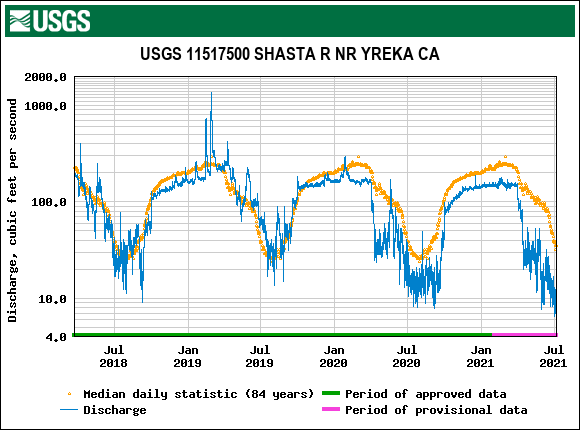
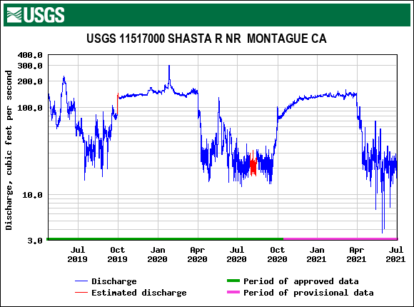
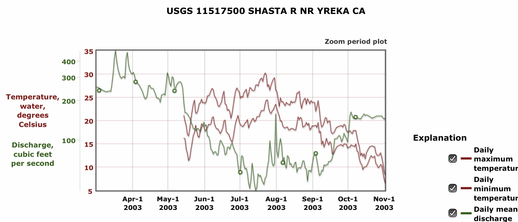
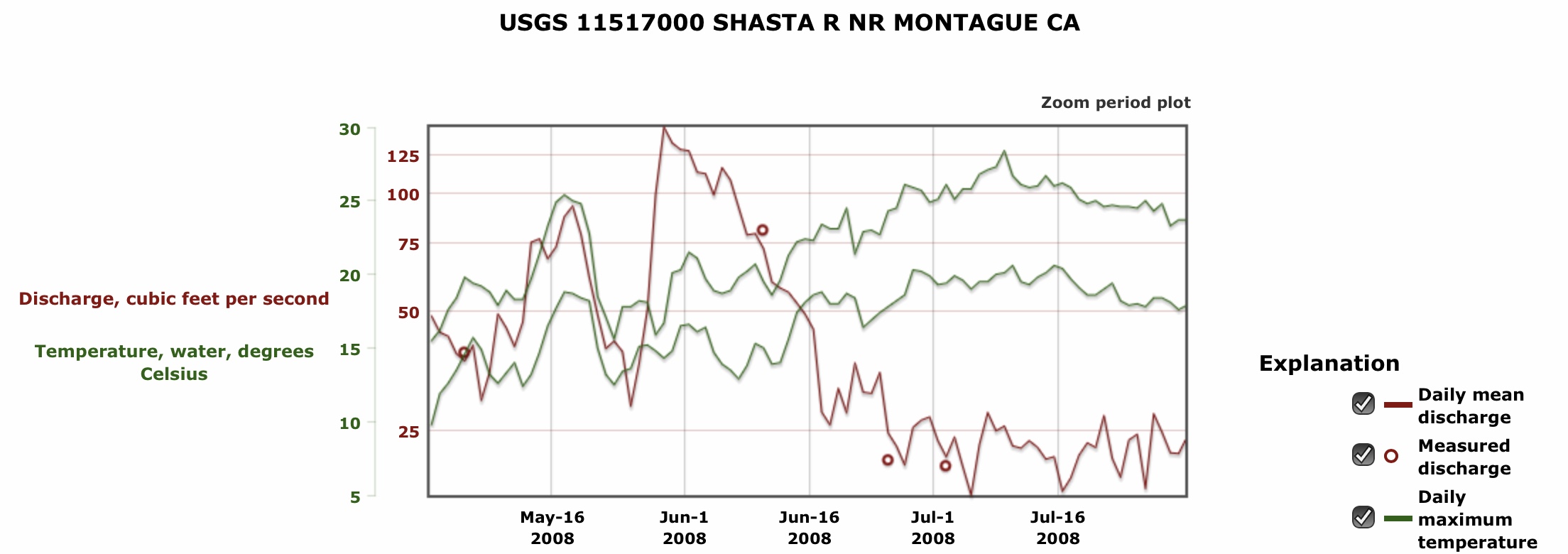
The Scott River has a chronic low streamflow problem that occurs in the summer and fall of most years. Only in very wet years, do ranchers and fish for the most part get the water they need. In most years, nearly all the water in the watershed goes to agriculture, while the lower river and its tributaries run virtually dry. Fish survive in the upper reaches of the river and in the lower tributaries that receive snowmelt and spring water from the adjacent Marble and Trinity mountains. There are also spring-fed refugia in the middle sections of the river and In tributaries to the lower sections of the river. But at many locations in the watershed, a large portion of the surface-water flow goes underground into near-surface aquifers, only to resurface as springs and be further diverted or extracted by wells, or go back underground.
The California Department of Fish and Wildlife is recommending summer minimum flows from 30-50 cfs at the lower end of the river to protect over-summering juvenile Chinook and Coho salmon, and steelhead. These recommended flows represent roughly half of the available summer baseflow water supply in the Scott River. Without a minimum flow requirement, almost the entire summer baseflow is consumed by a carefully distributed water supply extraction system regulated by seniority-based surface water rights and overseen by the State Board or by minimally regulated groundwater pumping. A large portion of the consumption occurs by means of minimally regulated shallow well pumping from the valley’s alluvial floodplain aquifer. This supplies water for stock watering, pasture irrigation, or large scale sprinkler irrigation of hayfields. The aquifer is recharged by surface flows and applied irrigation, and in places is augmented by beaver dam flooding. The floodplain was once known as “beaver valley”. However, much of such wetland floodplain habitat has been lost to channelization to enable irrigated agriculture.
There are many areas in the watershed that provide refugia for over-summering salmon and steelhead. The extent of these refugia decreases over the summer as the surface water supply declines and springs cease flowing. The loss of refuge habitat over the summer is greatest in drought years. As the extent of refuge habitat declines, juvenile salmon and steelhead become more concentrated or succumb to “catastrophic stranding” where they die from refugia drying up or overheating. Many refugia are on private lands. Many are unidentified. They need to be identified and surveyed to determine their characteristics and need for protection.
Drying rivers also pose problems for emigrating juvenile and immigrating adult salmon and steelhead in the fall and winter. When fall rains and winter snow are lacking or late, juvenile fish are hindered or blocked from moving downstream to the Klamath River. Adult fish cannot move upstream to spawning grounds in the valleys.
General Solution Options for the Scott River
Other than CDFW’s recommended minimum instream flows to save the fish (which would be successful), there are further options to help the fish. One major option is to protect through the summer-fall season the many refuge areas that are present and functioning at the end of the spring snowmelt season. This can be accomplished in several ways: (1) not allowing any diversion of surface or groundwater within or near the designated refuge; (2) pumping well water directly into the refugia; (3) diverting other surface waters into the refugia; and (4) protecting and enhancing refuge habitat (e.g., cattle fencing, riparian plantings, channel improvements). The basic concept is to protect and enhance cold-water habitats of the refugia. Each refuge will have its own prescription. Some may benefit from introduced beaver colonies. Note that some landowners working with CDFW and local stakeholder groups have accomplished some of these actions at varying scales of effort and with varying degrees of success.
Another solution option is a program to scale back seasonal agricultural water use based on the needs of fish and their habitat, as well as those of the landowners. For example, a major problem for Scott River salmon is not being able to ascend into Scott Valley in the fall because of low streamflows. Unlike the Shasta River Watershed, in which irrigation is disallowed after October 1, irrigation is allowed into December in the Scott watershed. Scott Valley hay-crop irrigators in particular could cease irrigating a month or two earlier, foregoing late season cuttings. This option was suggested by a landowner of a large ranch who was even willing to use his large-capacity wells to help water the river during the fall salmon migration.
Specific Recommended Solutions
The following recommendations offer large potential benefits with limited impacts and costs.
1. Focus on the surface water irrigation diversions – all should cease in summer of dry years
Two large diversions with large canal distribution systems make up the bulk of the surface water diversions in Scott Valley, at least in wetter years or spring of drier years. If these have not as yet cut back diversions as in most dry years, their diversions should cease. The largest diversion, Young’s Dam, is a relatively large concrete structure with a fish ladder (Figure 2). In summer of dry years, it usually does not divert, but does back up water in the river channel, causing significant rises in water temperature. More flow would minimize such heating. More flow is necessary to provide upstream passage of adult salmon in late summer and fall through the dam’s fish ladder, even when the dam is not diverting water.
The second largest surface diversion is Farmers Ditch, which diverts directly from the Scott River channel (Figure 3). It too usually does not divert in summer of dry years, due to lack of surface flow. Prior to ceasing its diversions, it contributes to drying up the river in the downstream tailings reach.
There are many small diversions in the middle and upper valley from reaches of the river and lower tributaries that retain flows in the summer. Locally, they divert significant portions of the available streamflow. Some are crudely designed and operated, and are unregulated (Figure 4). All surface diversions should cease operating, since most are from spring-fed stream reaches supporting rearing salmon and steelhead. In many cases, such diversions contribute to the dewatering of downstream reaches. One such example is lower Shackleford Creek, where multiple small diversions in flowing spring-fed sections in the several miles upstream contribute to the drying up of the creek near its mouth on the Scott River (Figure 5).
2. Middle and lower reaches of Scott River affected by groundwater pumping – all well pumping from locations contributing to dewatering of the main channel of the Scott River or lower tributaries should cease pumping.
Most free-flowing reaches of the middle and lower Scott River and its lower tributaries are over-summering juvenile salmon and steelhead refugia. Even warm low flows provide some cooler hyporheic flow to sustain young salmon and trout in microhabitat areas of the stream channel (Figure 6; also see videos referenced at the end of this post). Such locations cannot support high population densities for long and thus could use added flow to sustain them.
3. Refugia in middle and lower reaches of Scott River and lower tributaries affected by groundwater pumping could be supported by pumping cold groundwater into stream channels to help sustain refuge habitat.
In reaches where groundwater pumping is no longer needed, idle wells can pump cold groundwater directly into stream channels to sustain specific refugia or to provide added flow for fish migrations. Many ponds situated within the Valley’s water table have cold water that could be drained or pumped to refuge areas. The tailings reach in the upper end of the Valley has many such ponds.
Summary and Conclusions
All surface diversions from free-flowing reaches of the Scott River should cease in summer-fall of 2021. All such reaches are fed by snowmelt or springs, and are most likely refugia for over-summer rearing salmon and steelhead. All well pumping near the river and lower tributaries that may affect springs or hyporheic flow in refugia should be cut back to help sustain the refugia. All refugia should be identified and classified to value and need. Where feasible, wells or surface waters can supply supplemental water to sustain refugia. All refugia should be mapped, surveyed, and characterized for need; high value options should be identified and implemented. All irrigation in the Scott Valley (not including stock watering) should cease by October 1, as is already done in the Shasta Valley. Cutbacks of well pumping for Scott Valley irrigation should commence on a graded scale on August 1 and September 1.
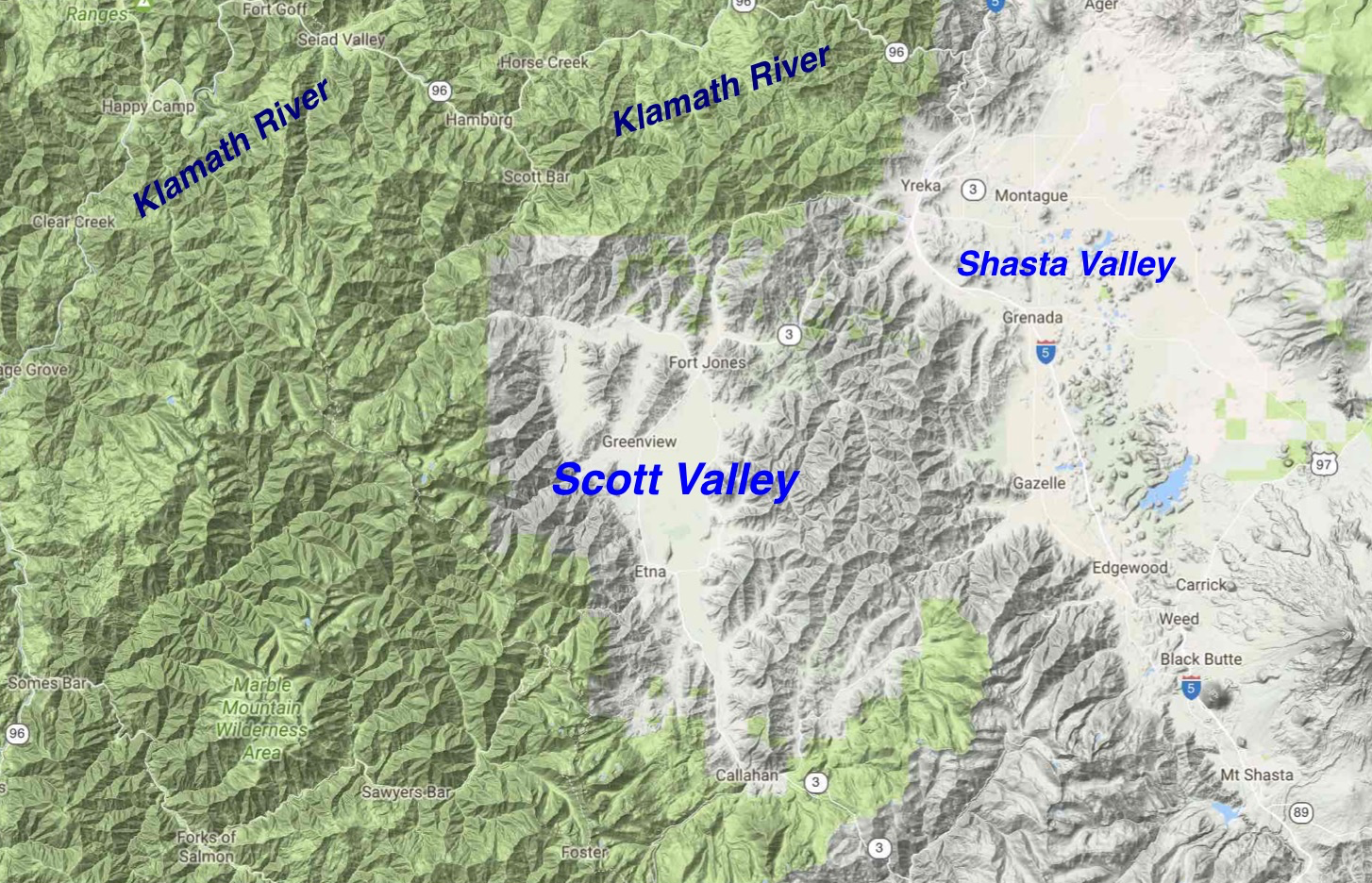
Figure 1. The Scott River and Shasta River Valleys in northern California west of Yreka, CA (Yreka is located in the Shasta River Valley). The Scott and Shasta Rivers flow north into the Klamath River, which runs west to the ocean. The Salmon River watershed is immediately west of the Scott River watershed. The upper Trinity River watershed is immediately to the south of the Scott River watershed.
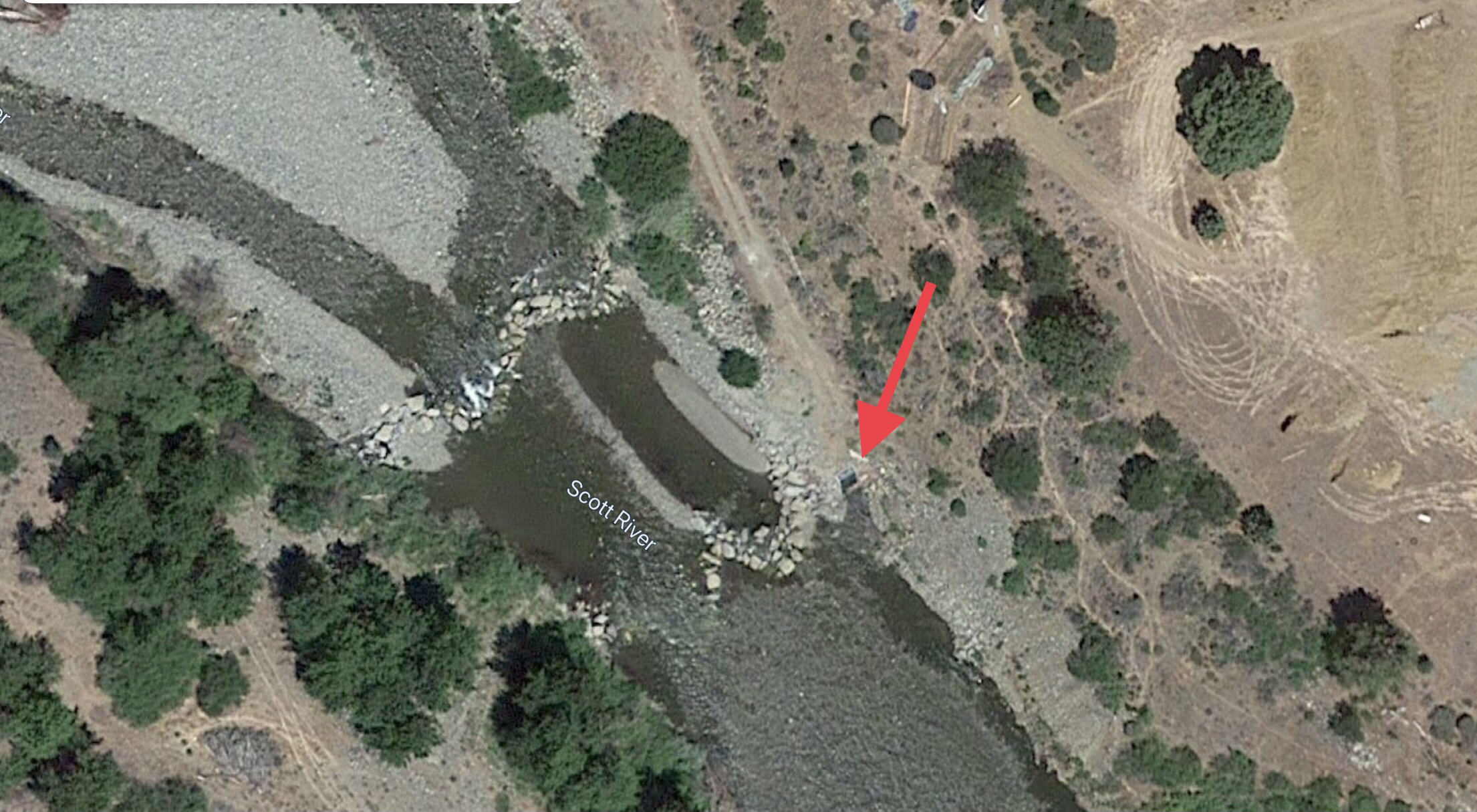
Figure 3. Farmers Ditch diversion located in upper middle valley on Scott River.
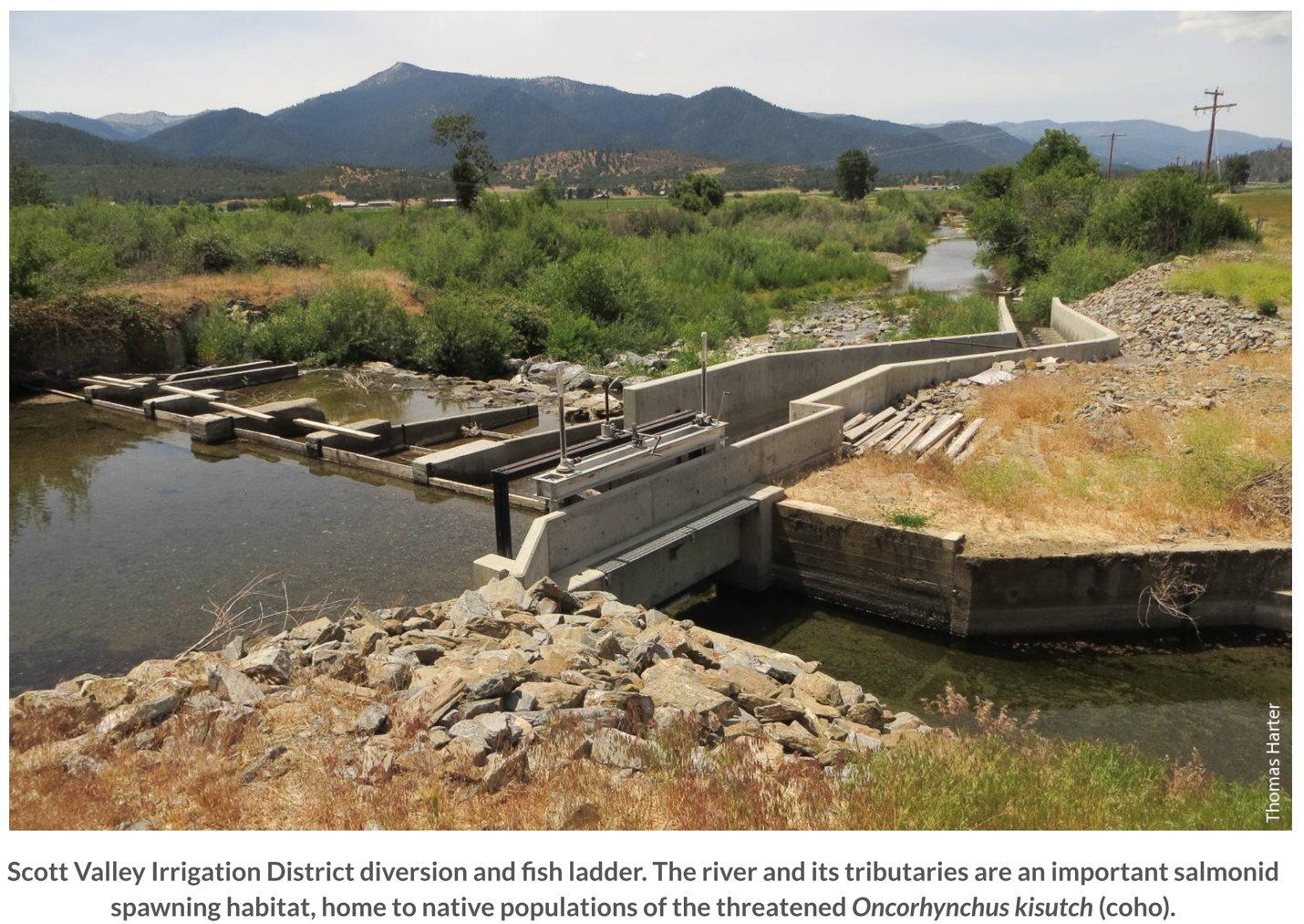
Figure 2. Young’s Dam and diversion located on the Scott River in mid-Valley.
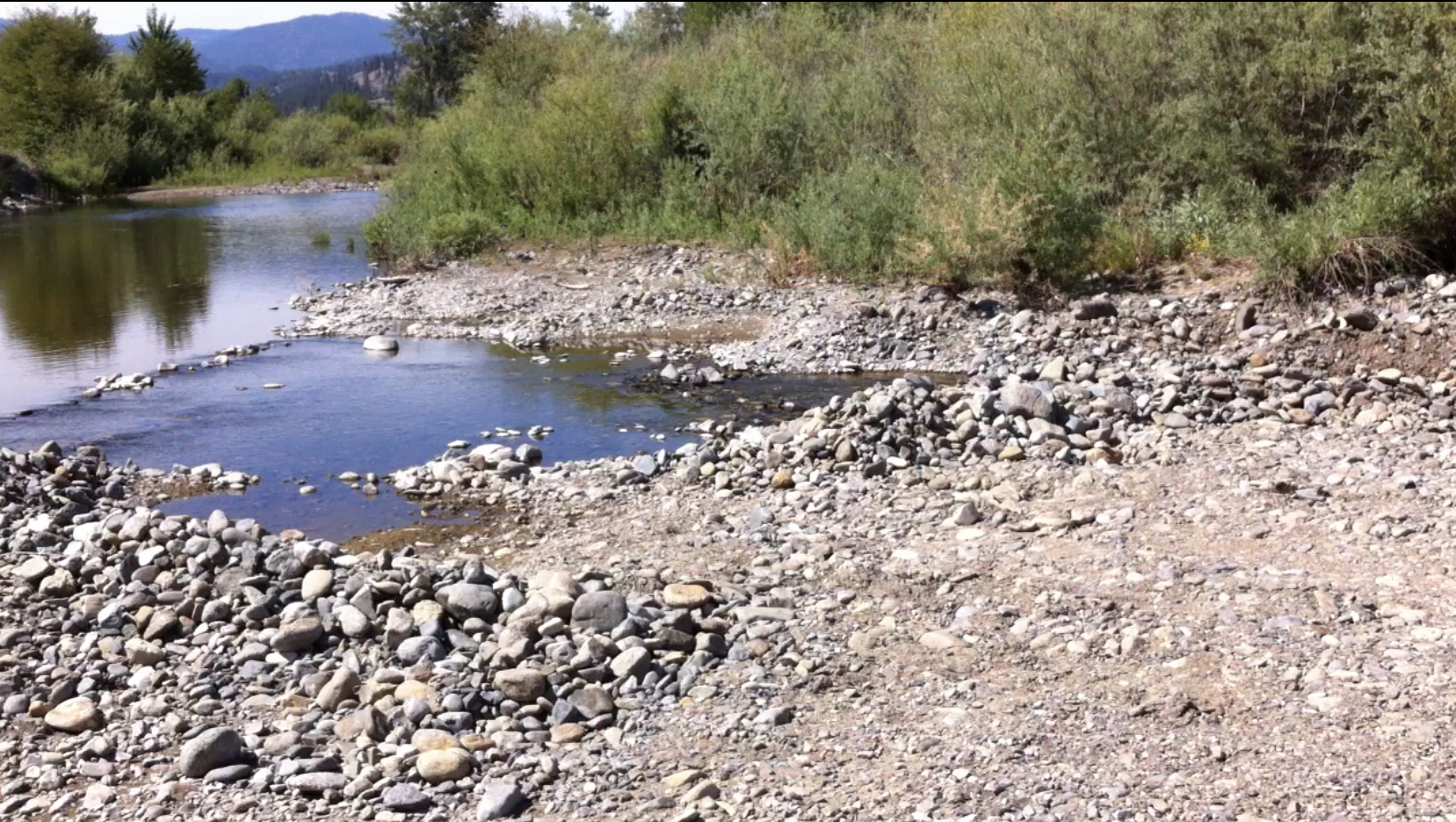
Figure 4. An unnamed small diversion located in spring-fed reach of Scott River below tailings reach. Both the river and diversion ditch contained large numbers of juvenile coho salmon.
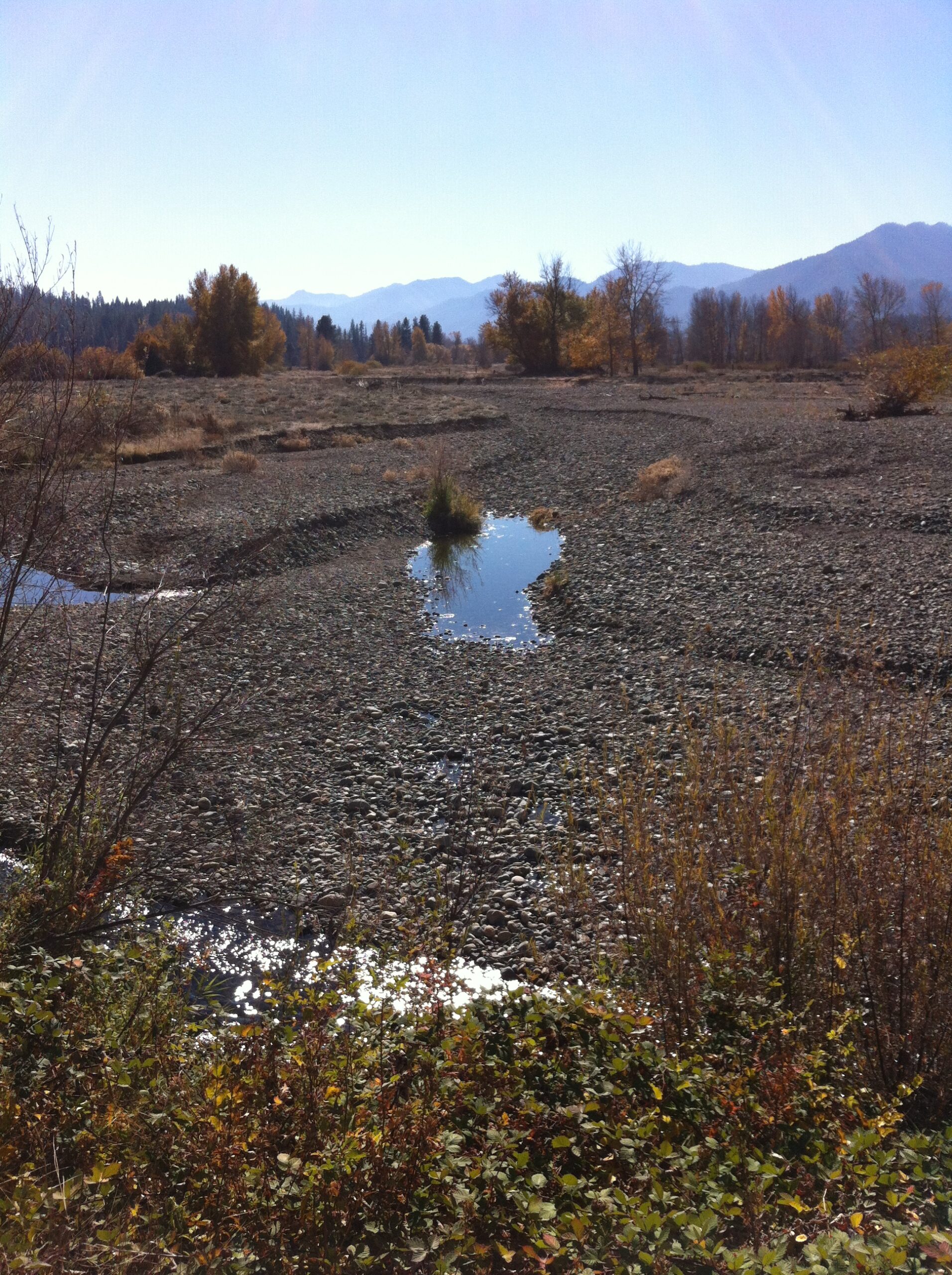
Figure 5. The mouth of Shackleford Creek on Scott River in late summer.
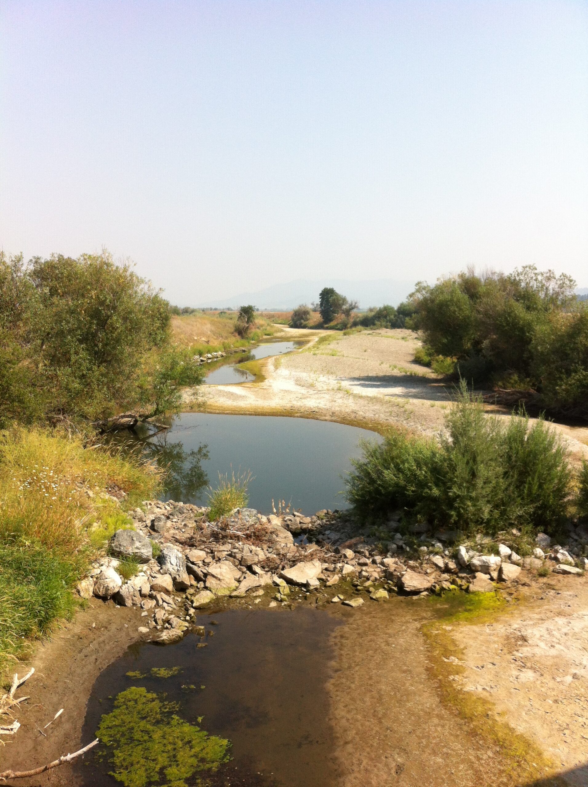
Figure 6. Reach of the lower Scott River upstream of Fort Jones near Eller Bridge, nearly dewatered by groundwater pumping and lowering of the groundwater table. Despite lack of flow, the reach retains some over-summering refuge pools sustained by groundwater and hyporheic flow. Eventually, these areas become too warm, and many thousands of juvenile salmon and steelhead die. Such areas would benefit from a cessation of irrigation with water sourced from adjacent wells. Idle wells could be employed to add cold water to sustain the refugia.
Available Videos of Scott River Refugia

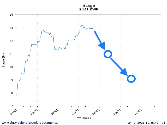

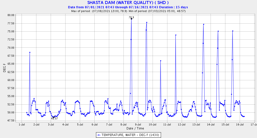
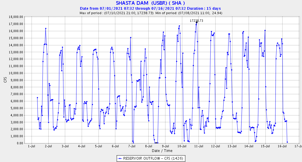 Figure 3a and 3b. Hourly water temperature (a) and flow (b) release pattern from Shasta Dam during first half of July 2021. Note most peaking-power releases are in afternoon and evening hours, with water temperatures several degrees higher during the daily peak generation. Daily average releases were 6500-7500 cfs, with peaks on the 6th and 9th.
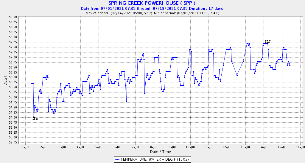
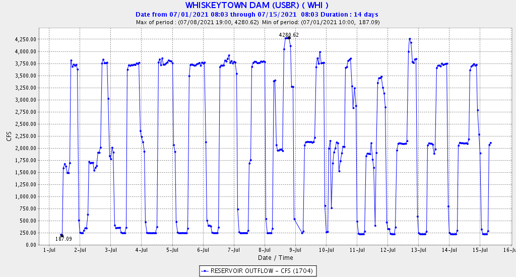 Figures 4a and 4b. Hourly water temperature (a) and flow (b) release pattern from Whiskeytown Dam during first half of July 2021. Note most peaking-power releases are in afternoon and evening hours, with water temperatures in the middle range of the daily pattern or about 1ºF below the daily maximum. Note the base flow of 250 cfs is to Clear Creek, with the remainder to Spring Creek powerhouse on Keswick Reservoir. Also, note peak releases to the Spring Creek powerhouse were about 3500 cfs for 12 hours from July 3-8. Daily average releases rose from about 1000 cfs on July 1 to 2000 cfs on July 4, then dropped to 1500 cfs on July 11, only to increase again through July 15.