
The central Delta plankton bloom described in my April 23 post has dissipated (Figures 1 and 2). The bloom was a consequence of long residence time of water in the lower San Joaquin River channel in the central Delta. The increased residence time resulted from a combination of low south Delta exports during April (1500 cfs), low net flows in the lower San Joaquin River (Figure 3), and a prescribed San Joaquin River “pulse flow” (Figure 4). A high “spring” tide period from 4/17-4/25 (Figure 5) likely helped sustain the bloom by restricting Delta outflow (see Figure 3).
The San Joaquin pulse flow had a double benefit: 1) it provided key nutrients to stimulate the bloom, and 2) it reduced south Delta export demand from the bloom area in the central Delta. The pulse flow is indicative of normal San Joaquin April flows, while the extremely low flows subsequent to the April pulse were allowed by the State Water Board in drought-related change orders.
These events are important because they highlight the importance of San Joaquin River inflows and monthly tidal cycles in the Delta for Delta Smelt and Longfin Smelt rearing in the Delta. Smelt are significantly affected by their plankton food supply and the potential entrainment of that food supply into the south Delta export pumps. The pulse flow, like other management actions, should be considered an adaptive management experiment from which valuable insight might be learned for managing the Delta. The bloom was a very rare event, and the circumstances behind it could be important in the future management of the Delta.
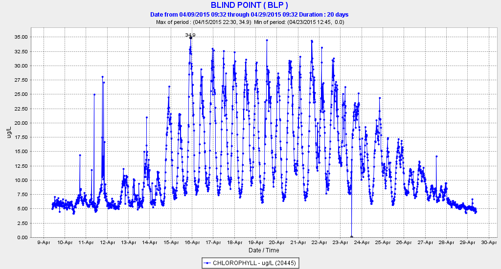
Figure 1. Chlorophyll levels at Blind Point in the western Delta in the San Joaquin River channel during April 2015. (Source: CDEC)
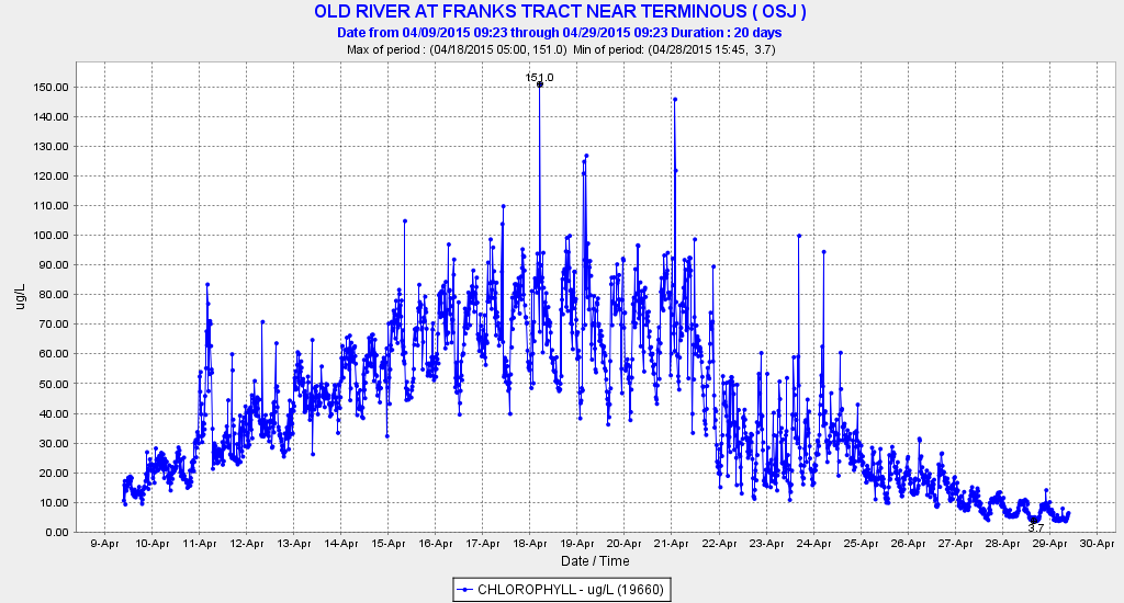
Figure 2. Chlorophyll levels in Old River adjacent to Franks Tract in the central Delta during April 2015. (Source: CDEC)
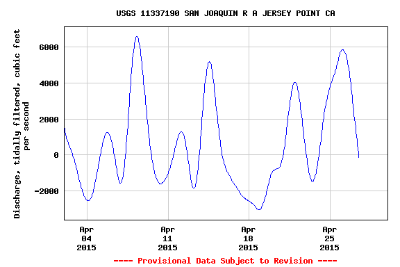
Figure 3. Net flow in the lower San Joaquin River near Jersey Point. (Source: USGS).
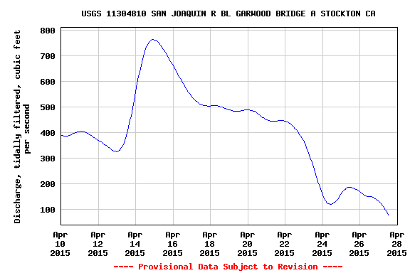
Figure 4. Net inflow of the San Joaquin River at Stockton in April 2015. (Source: USGS)
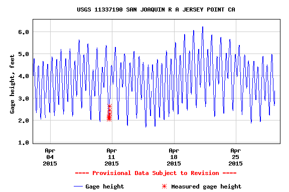
Figure 5. Tidal effect on water surface elevation at Jersey Point in the lower San Joaquin River in April 2015. A “spring” tide occurred from 4/17-4/25. (Source: USGS)