Reclamation Jeopardizes Klamath and Sacramento Salmon

By now you have probably heard that Klamath salmon are again threatened by warm water and ICH disease. You may also know that Sacramento River winter run salmon are again threatened with warm water below Shasta at Redding. You may not know that both are related, caused by the US Bureau of Reclamation’s operation of the Central Valley Project (CVP) and in particular Shasta and Trinity reservoirs.

Low flows in the lower Klamath are resulting in warm water and disease, shaping up as having the potential to repeat the massive 2002 die-off of salmon. Water temperatures in the lower Klamath and Trinity near 80°F are killing salmon and blocking their migrations.

Below Shasta on the Sacramento River near Redding, Winter Run Chinook salmon eggs are dying because excessively warm water is being released from Keswick Reservoir near Redding. Water temperatures near or above 60°F occur from Redding down to Red Bluff, the traditional spawning reach of Winter Run Chinook in summer. Egg mortality increases above 56°F.

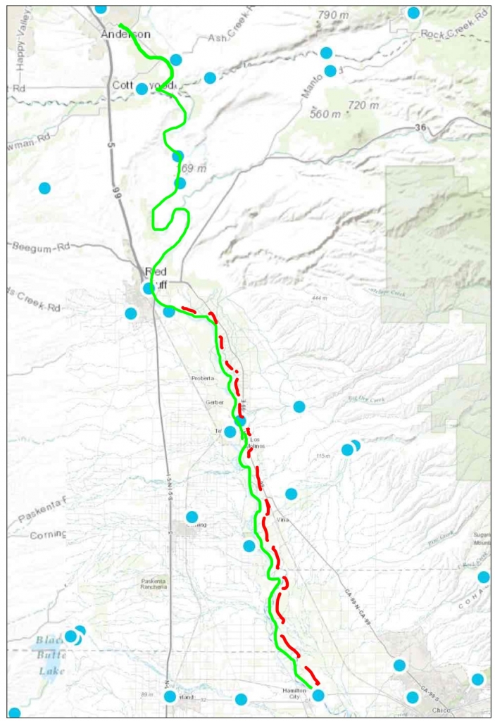
Here is how the two events are related. The map below shows how the Shasta andTrinity projects are connected as part of the CVP. Trinity Reservoir is presently releasing about 2000 cfs, of which a little less than 500 cfs (52-59°F) is released down the Trinity into the lower Klamath where total flow is 2200 cfs and water temperatures approach 80°F. The other 1500 cfs from Trinity Reservoir is going to Keswick Reservoir via Whiskeytown Reservoir. This 59°F water from Whiskeytown mixes with 5500 cfs of 52°F water released from the Shasta cold-water pool to provide a release of 7000 cfs of 54-56°F water into the Sacramento River from Keswick Dam above Redding. Water temperatures in the Redding spawning reach are 56-60°F.

So the flows diverted from the Trinity are not only contributing to low flows and warm water in lower Klamath, they are also contributing to the water in the Sacramento at Redding that is too warm for salmon eggs. The need to cool Trinity water before it is released into the Sacramento below Keswick is also contributing to the depletion of the limited cold water pool in Shasta reservoir.

Klamath River tribes are asking for more water down the Trinity. Reclamation is offering a small pulse when salmon start to die. A better solution would be to equally split the Trinity release, providing an immediate benefit to the Klamath-Trinity salmon and also saving some of the cold water pool in Shasta. This would require the State Board to reduce deliveries to Sacramento Valley farmers by an additional 500 cfs.

Proposed Actions Reservoirs and Dams

Recent Delta Action Further Degrades Low Salinity Zone

Recently, Reclamation closed the Delta Cross Channel (DCC) (Figure 1) near Walnut Grove to reduce salinity at the State Board’s compliance point at Threemile Slough. Normally, the DCC is open in summer to allow fresh water into the central, east, and southern Delta to maintain low salinity water for exports and for agricultural and municipal diversions. However, low fresh water inflows to the Delta due to the drought have resulted in salinity levels exceeding the required 2.78 EC level at Threemile Slough. Closing the DCC effectively forced more of the fresh -+water inflow from the Sacramento River toward the western Delta and Threemile Slough, reducing EC at Threemile Slough significantly (Figure 2).

Figure 1. Flow through the Delta Cross Channel in July and August 2015

Figure 1. Flow through the Delta Cross Channel in July and August 2015. Zero flow indicates the gates are closed. Gates are normally open in summer.

Figure 2. Salinity (EC) at Threemile Slough compliance point in western Delta

Figure 2. Salinity (EC) at Threemile Slough compliance point in western Delta. Salinity (EC) must be maintained below 2780 EC on a seven day average. Salinity exceeded the target on July 18. Closing the DCC on July 19 immediately reduced salinity to the compliance level. Subsequent closing of the DCC on July 25 brought salinity back up to and exceeding pre-closure levels. As the seven day compliance target was again exceeded August 1-3, the DCC was again closed on August 4 to again bring the salinity into compliance.

This rollercoaster salinity management in the Delta causes serious degradation to the Low Salinity Zone in the western Delta in the form of higher water temperatures. The higher water temperatures occur when warm northern Delta waters are moved west with the higher flows. These higher temperatures are evident at all the western Delta gages maintained by the Department of Water Resources and the US Geological Survey. The water temperatures change is approximately 2°F, which is significant and detrimental to the remnants of the Delta Smelt population trying to survive this extreme summer drought. Water temperatures have increased from 73° to 75°F, essentially creating lethal conditions for the remnant smelt.

The influx of warm water is apparent at Rio Vista where the Sacramento River enters the western Delta (Figure 4). Not only did the water temperature immediately rise with the higher flows on July 19, but the higher temperatures were sustained after the flows receded on July 25.

Overall, the unprecedented closure of the DCC in summer leads to rapid and significant changes in flow, salinity, and water temperature in the Delta that are likely detrimental to Delta native fishes including the Delta Smelt.

Figure 3. The map annotations depict changes from recent closures of the DCC

Figure 3. The map annotations depict changes from recent closures of the DCC (located at blue X). The closure reduced flow in the Mokelumne channels (dotted red line) by 3000 cfs. Georgiana Slough (west side of Tyler Island) flow increased 1000 cfs. Flow into the Sacramento channel at Rio Vista increased 2000 cfs. Net water temperature increase throughout the western Delta was about 2°F.

Figure 4. Water temperature at Rio Vista Bridge in July-August 2015

Figure 4. Water temperature at Rio Vista Bridge in July-August 2015. Note sharp increases after July 19 and August 4 closures of DCC.

Improving Water Temperature Management in Sacramento River Below Shasta for Salmon

Background

The Sacramento River below Shasta-Keswick near Redding is the spawning reach of Winter-Run Chinook salmon in summer. Winter-Run originally spawned in the cold, spring-fed reaches upstream of Shasta Reservoir. Since Shasta Dam’s construction over a half century ago, Winter-Run have spawned below in Shasta’s cold tailwater. However, in some dry years the cold water has run out and the Winter-Run spawn has failed, as was the case in late summer 2014. There simply are not sufficient guarantees in the State Water Right Order 90-5 (WRO-90-5) or the NMFS Biological Opinion (BO) to protect the Winter-Run: there weren’t in 2014 and there aren’t in 2015. Winter-Run need cold water (<56°F) through the summer to protect spawning adults, eggs laid in gravel, and fry developing in gravel beds throughout their spawning reach upstream of Red Bluff. In nearly all years there is sufficient cold water in Shasta to sustain cold water through the summer above Red Bluff, especially after construction of the Shasta Dam Temperature Control Device (TCD), which allows conservation of the coldest water in Shasta through the summer. The problem is that the cold water cannot be conserved because of downstream demands on the water.

Downstream agricultural demands force the release of too much of the Shasta cold water pool in spring and summer, which in drier years like 2014 and 2015 results in exhaustion of the cold water pool by late summer. To complicate matters, warmer Trinity water is brought over for release below Shasta to meet some of the downstream demands, thus requiring even more of the Shasta cold water pool to maintain target temperatures above Red Bluff. Shasta releases also are highest in warm afternoons to meet peak power demands; this release pattern also requires more from the cold water pool.

The federal and state agencies develop a plan to operate the system each year in the winter prior to the irrigation season. Based on what they know and forecast for the upcoming season, they develop a plan to maintain cold water through the summer for the salmon, as well as a forecasted water supply for downstream users. Both the WRO-90-5 and BO contain provisions that allow the targets for salmon temperatures to be modified in dry years to allow downstream water users a portion of their normal water supply.

WRO-90-5 allows weakening of targets for water temperature by moving the compliance point upstream from Red Bluff, sometimes as far as Redding. In 2015 the State Board in a Temporary Urgency Change Order allowed the target temperature to be raised to a daily average of 58°F in Redding.

The Problem

Both the 2014 and 2015 plans failed to meet their objectives for a multitude of reasons, least among them inaccurate information and poor planning tools (e.g., mathematical models). Lack of conservative conditions in the plan and follow-up conservative decision-making were the key problems. In 2014, the plan and operational failure led to the loss of most of the 2014 Winter-Run salmon production; the Winter-Run perished in low flows and high water temperatures in late summer in the small spawning reach upstream of Highway 44 in Redding. By late spring of 2015, it became apparent, as predicted by CSPA and others, that the Bureau had allocated spring releases (already made to downstream users) based on a forecast that overestimated the size and quality of the Shasta cold water pool . So the State Board allowed the Bureau of Reclamation to adopt a new temperature management plan, raising the target to an average daily temperature of 58°F even in the tiny amount of the Sacramento River between Keswick Dam and Clear Creek.

What more can be done?

First, rescind the weakened numeric target because it does not protect salmon eggs and newly newly hatched fry. The 56°F target must be reinstated as far downstream as possible. The SWRCB should at the very least ensure that maximum water temperatures never exceed 58°F and that average daily and weekly average maximums do not exceed 56°F.

Minimum water temp chartSecond, reduce the input of warmer Trinity water via Whiskeytown and the Spring Creek Powerhouse. The chart of present conditions below shows that the warmer Trinity water entering Keswick Reservoir below Shasta makes up over 20% (1500/7000) of the water entering the Redding reach. Ensuring that the Redding reach target is maintained requires that more 50°F cold-water pool water from Shasta be mixed into the TCD than would be necessary to maintain the mandatory 58°F average daily target at Redding (CCR location) without the Trinity water. Cutting the Trinity input at this time would be especially prudent. Low flows in the Trinity (460 cfs release to river, compared to 1500 cfs diversion to Sacramento River) are contributing to disease and die-off of salmon in the lower Klamath-Trinity system. {Note: it may not be possible to reduce Trinity inputs without increasing Shasta releases because salmon have or are now spawning at these flows. Cutting Trinity inflow could still reduce demand on Shasta cold water pool water even if Trinity flow cuts are made up by Shasta water.}

This map depicts conditions in the first week of August 2015.  Daily average Shasta releases to Keswick Reservoir are approximately 5500 cfs. Daily average Whiskeytown releases to Keswick are 1500 cfs.  Keswick release is approximately 7000 cfs.  The daily range in water temperatures is shown by location in magenta.  Gaging and recording stations are blue dots (from CDEC).

This map depicts conditions in the first week of August 2015. Daily average Shasta releases to Keswick Reservoir are approximately 5500 cfs. Daily average Whiskeytown releases to Keswick are 1500 cfs. Keswick release is approximately 7000 cfs. The daily range in water temperatures is shown by location in magenta. Gaging and recording stations are blue dots (from CDEC).

Third, reduce hourly peaking power releases from Shasta, because water released through the Shasta powerhouses is pulled from relatively high in the water column, and is thus relatively warm. Data from the past several days indicates Reclamation may already be instituting this measure – see figures below.

Water temperature recordings from one of five Shasta Dam penstocks over past ten days note high daytime water temperatures..  Lower maximum temperatures in last five days may be from reduced daytime releases or changes in TCD operation (see chart below).

Water temperature recordings from one of five Shasta Dam penstocks over past ten days note high daytime water temperatures.. Lower maximum temperatures in last five days may be from reduced daytime releases or changes in TCD operation (see chart below).

Note high daytime releases to meet peak power demands.  Note Reclamation has altered the normal pattern in the last two days, which apparently further reduced release water temperature (see chart above).

Note high daytime releases to meet peak power demands. Note Reclamation has altered the normal pattern in the last two days, which apparently further reduced release water temperature (see chart above).

In summary, saving Winter Run Chinook salmon this summer demands immediate action. This will require one or more of the following: reduced reservoir releases to downstream users, less transfer of warm water from Trinity Reservoir (via Whiskeytown and Spring Creek Powerhouse), reduced power generation, less peaking power operation, and/or the bypass of releases past Shasta’s power generation facilities (use of Shasta Dam’s lower level outlet).

Are popular trout fishing waters too warm to fish?

The Wild Fish Conservancy and other fishing groups have sent a request to the governors and fish & wildlife department directors and commissioners of Washington, Oregon, and California, and NOAA Fisheries, “urging the states to immediately implement emergency measures that would close all river reaches to all fishing, both recreational and commercial, that exceed 18°C (64.4°F), until water temperatures and flows return to more normal conditions”.1 The petition notes that the drought (they referred to as “weather abnormalities”) have caused low flows and high water temperatures in rivers, streams, and lakes.

“A report released today by the Conservancy indicates that current water temperatures in almost all salmon and trout bearing rivers and streams analyzed in Washington, Oregon, and California have exceeded thresholds which result in biological stress, indirect mortality, and reduced spawning success. Furthermore, lethal conditions were detected in 39 of 54 of the rivers and streams.”

CDFW, in its CDFW News Blog, recommended on June 22 that anglers not fish whenever water temperatures exceed 70°F. 2

While the threshold temperature for the decision not to fish is somewhat species dependent, anglers should give careful thought to where they fish in hot weather, low water conditions.

Northern California Lakes and Reservoirs

Popular trout fishing locations in northern California include Shasta, Oroville, Almanor, Davis, Eagle, Siskiyou, Bullards Bar, and Folsom reservoirs, as well as many smaller foothill and Sierra lakes and reservoirs. Nearly all of these waters have surface temperatures in the mid-seventies in summer. Although these are not wild trout fisheries and are sustained primarily by stocking, many are quality fisheries that have carryover trout prized by many fishermen. Catch-and-release should be discouraged in these waters in summer, as many of the trout (and salmon) caught would likely die if released. Some guides and private waters no longer offer fishing in these waters because of the warm water. Harvested fish should be immediately put on ice and not on stringers.

Northern California River and Streams

Northern California is rich in cold water stream fisheries sustained by large springs (e.g., Hat Creek, Fall River, upper Battle Creek, upper McCloud, and upper North Fork Feather), and by others sustained by cold-water reservoir releases (e.g., upper Lower Trinity River, upper Lower Sacramento River below Shasta, and lower Yuba River). These waters can sustain fisheries through the summer even in most drought years.

However there are some streams that should be closed, partially closed, or considered for closure on a case-by-case basis. These include the Klamath, lower Trinity, lower sections of the upper Sacramento and lower McCloud, the Pit above Shasta, and the lower Truckee rivers.

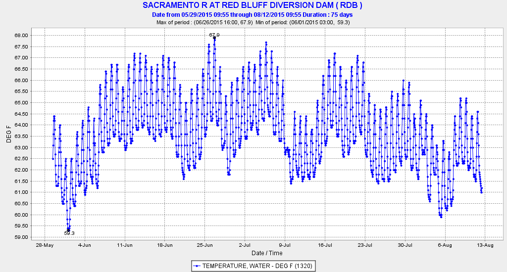
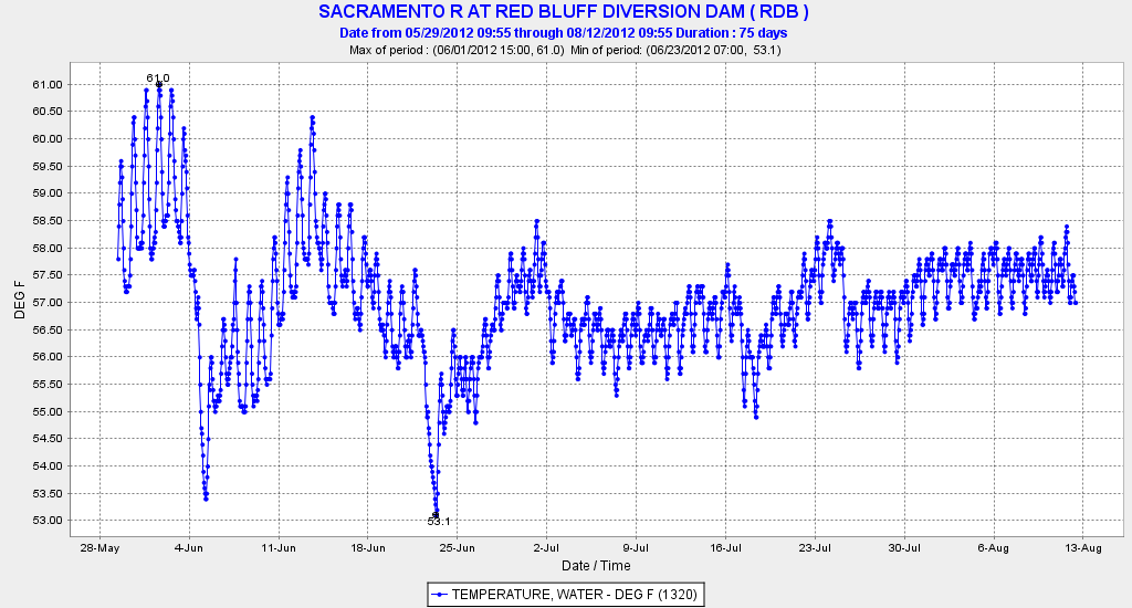
Some selected water temperature charts are included below. They are available on CDEC, DWR’s streamflow and reservoir website.3 Check the web before you head out.

DLT Temprature

Upper Sacramento River upstream of Shasta Reservoir

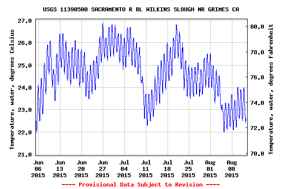
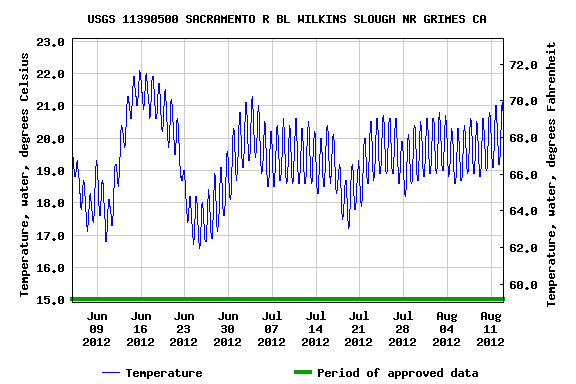
Lower Sacramento River below Redding.

Lower Sacramento River below Redding.

McCloud River above Shasta Reservoir

McCloud River above Shasta Reservoir

Lower Truckee River near Nevada border.

Lower Truckee River near Nevada border.

Lower Yuba River below Englebright Dam

Lower Yuba River below Englebright Dam

Lower Klamath River.

Lower Klamath River.

Lower Trinity River.

Lower Trinity River.

  1.  http://wildfishconservancy.org/about/press-room/press-releases/extreme-water-temperatures-low-flows-in-pacific-northwest-rivers-creating-lethal-conditions-for-salmon
  2. https://cdfgnews.wordpress.com/ (Search June 22, 2015)
  3. http://cdec.water.ca.gov/river/rivcond.html It takes some trial and error to find the temperature plots, and not all stations have them. Generally, if you click on the title in blue below each graph it directs you to a list of data available for the station. The blue headers for each category of data are links, which opens up further graphing functions.

It is time to save the Delta Smelt

Causes of the Decline of the Endangered Delta Smelt

There are multiple threats to the Delta Smelt population that contribute to its viability and risk of extinction. Chief among these threats are reductions in freshwater inflow to the estuary; loss of larval, juvenile and adult fish at the state and federal Delta export facilities and in urban, agricultural and industrial water diversions; direct and indirect impacts of the Delta Smelt’s planktonic food supply and habitat; and lethal and sub-lethal effects of warm water and toxic chemicals in Delta open-water habitats.

Temporary urgency change orders by the State Board have allowed reduced Delta outflow and increased Delta salinity. This has moved the Low Salinity Zone further upstream (eastward) into the Delta, thereby increasing the degree of each of these threats. During the past few drought summers, remnants of the population have been confined to a small area of the Low Salinity Zone where water temperatures barely remain below lethal levels. The change orders are an obvious and direct threat to the remnants living in the Low Salinity Zone. Further allowing these weakened standards to be violated is a direct disregard for the remnants of the population. It places them at extraordinary risk by bringing them further into the zone of water diversions, degrading their habitat into the lethal range of water temperature, further degrading their already depleted food supply, and increasing the concentrations of toxic chemicals being relentlessly discharged into the Delta.

Saving the Delta Smelt

The following are measures necessary to save the remnant Delta Smelt population:

  1. Keep the low salinity zone (LSZ) out of the Delta as prescribed in State water quality control plans over the last several decades. This can be readily accomplished by meeting already defined flow and salinity standards and restrictions on Delta exports. The LSZ on the Sacramento channel side should be in the wide open reach of eastern Suisun Bay between Collinsville and the west end of Sherman Island (location of Emmaton standard). It must be kept out of the Emmaton-to-Rio Vista reach just upstream in the west Delta, because this reach is confined and continually degraded by reservoir releases and warm water passing through the North Delta via Three Mile Slough to the interior of the Delta and south Delta water diversions. On the San Joaquin (south) side, the low salinity zone belongs in the wide Antioch–to-Jersey Point reach as prescribed in standards. This can be accomplished in spring and summer of dry years by maintaining prescribed flows, salinity standards at Jersey Point, installation of the False River and Dutch Slough Barriers, and opening the Delta Cross Channel (which results in positive net outflow from the mouth of Old River downstream to Jersey Point in the Central Delta). Maintaining the net positive flows in west Delta channels helps tremendously in getting salmon, steelhead, sturgeon, striped bass, and smelt from upstream freshwater spawning areas to their downstream rearing area target, the estuary’s LSZ. Keeping the LSZ in eastern Suisun Bay, as has always been an objective Delta Water Quality Plans, has huge indirect benefits as well, including greater plankton production, lower non-stressful water temperatures (conducive to growth and survival of all the Delta fish including smelt and salmonids), higher turbidity levels in the LSZ (reduced predation on and improved feeding for Delta smelt), lower invasive Asian clam concentrations in eastern Suisun Bay (which siphon off plankton and larval fish), and lower concentrations of toxins in the LSZ.
  2.  Improve the physical habitat of the LSZ. Habitat in eastern Suisun Bay, though far better than that of the west Delta, has been continuously degraded over the past century. Fortunately, there are few levees along the north shore of the Sacramento side. However, the wave-swept shores along Antioch Hills have lost all riparian vegetation except pockets of invasive Arundo. Hillside windfarm and shoreline erosion have filled in shoreline shoals, shallows, bays and alcoves that provided rearing habitat for smelt and salmon (salmon fry are the most abundant fish in these shallows through the winter). Miles of shoreline bays, inlets, and tidal marshes east of Collinsville have been lost. On the south side of the Sacramento channel are the remnants of historic Delta marshes and islands of West Sherman Island and Sherman Lake. Gradually the riparian shoreline and shallow waters are washing away as a consequence of wind as well as ship-wake erosion. Lack of interior marsh channel circulation has also led to grand infestations of invasive non-native submergent, emergent, and floating aquatic vegetation. Like the north shore, the south shoreline of West Suisun Bay on the San Joaquin side is not leveed. Likewise, shoreline and shallow water habitats are degraded, but from industrialization. Large areas east of Antioch to Big Break are degraded much as in the area of Sherman Lake. Both the north and south East Suisun Bay channels are degraded by dredging of the two deep-water ship channels, which has resulted in the loss of shallow shoal, bay, and mudflat habitats. Virtually none of the habitats mentioned above were addressed in the grand BDCP restoration plans for the Bay-Delta. Though some of the areas have been prescribed for restoration in various mitigation plans, virtually no progress has been made toward their restoration in the last several decades.
  3. Stock hatchery raised smelt in the LSZ. The agency-sponsored Delta Smelt conservation hatcheries could be upgraded to production status to provide juveniles to be stocked in the LSZ in late spring and summer. The population is so low now (zero 20-mm and Townet survey indices) that stocking would be helpful if not necessary.
  4. Provide a spring pulse flow into and through the Delta to help smelt fry transport from freshwater spawning areas downstream to the LSZ. This could include passing some Sacramento River flow through the blocked entrance to the Deepwater Ship Channel at the Port of West Sacramento. Delta inflow pulses could be provided by reservoir releases coordinated with infrequent natural flow pulses through the Delta.
  5. Manage tidal flows and Delta hydrodynamics, as well as water quality, on a real time basis to help maintain the LSZ in east Suisun Bay and to stimulate and sustain plankton blooms. Real time management is possible because of the many satellite-accessible data recorders in the Delta, as well as the many frequent biological monitoring surveys being conducted throughout the Bay and Delta. Active adaptive management is possible with the many flow controls available on diversions, reservoir releases, and flow splits (e.g., Delta Cross Channel).