The final rules adopted by NOAA Fisheries and California Department of Fish and Wildlife this spring will be much different than last year’s rules. The 2023 commercial and sport fishing closure is designed to ensure that adequate numbers of fall run salmon, the primary stock of the fishery, return to spawn this year and begin the recovery of the population to allow future fisheries. The Pacific Fisheries Management Council (PFMC) and the California Fish and Game Commission are taking this extreme action as their authorized contribution to the recovery of collapsed California’s salmon populations. This year’s salmon closure follows yet another three-year drought (2020-2022) and associated water mismanagement.
But the work does not stop at closing the season. The legal authorities of other state and federal agencies must now kick in and do their part. With the salmon out in the ocean now protected, the next steps are to protect broodyear 2022 that is now in the rivers and the Bay-Delta estuary, and to be ready for the return of remaining broodyear 2019 and broodyear 2020 and 2021 adult salmon that will re-enter fresh water to spawn this fall and next year.
Hatchery Production
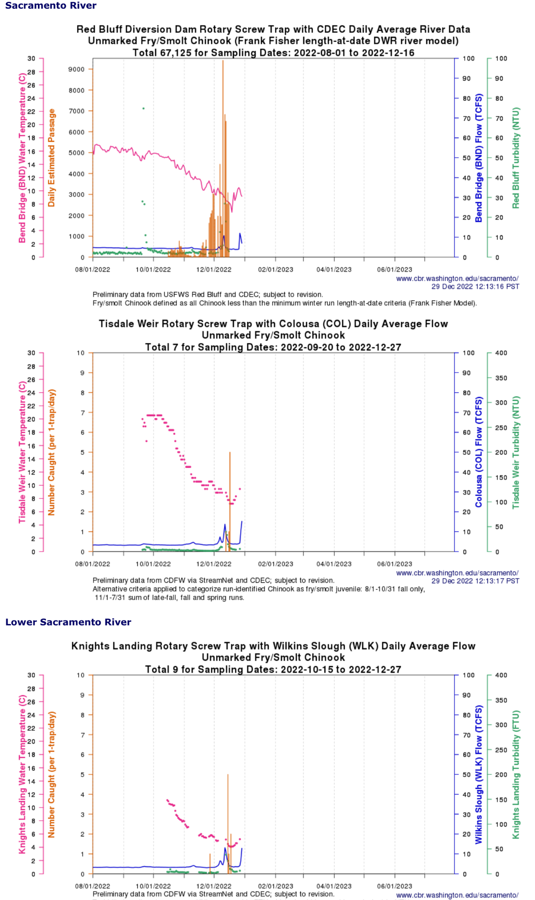
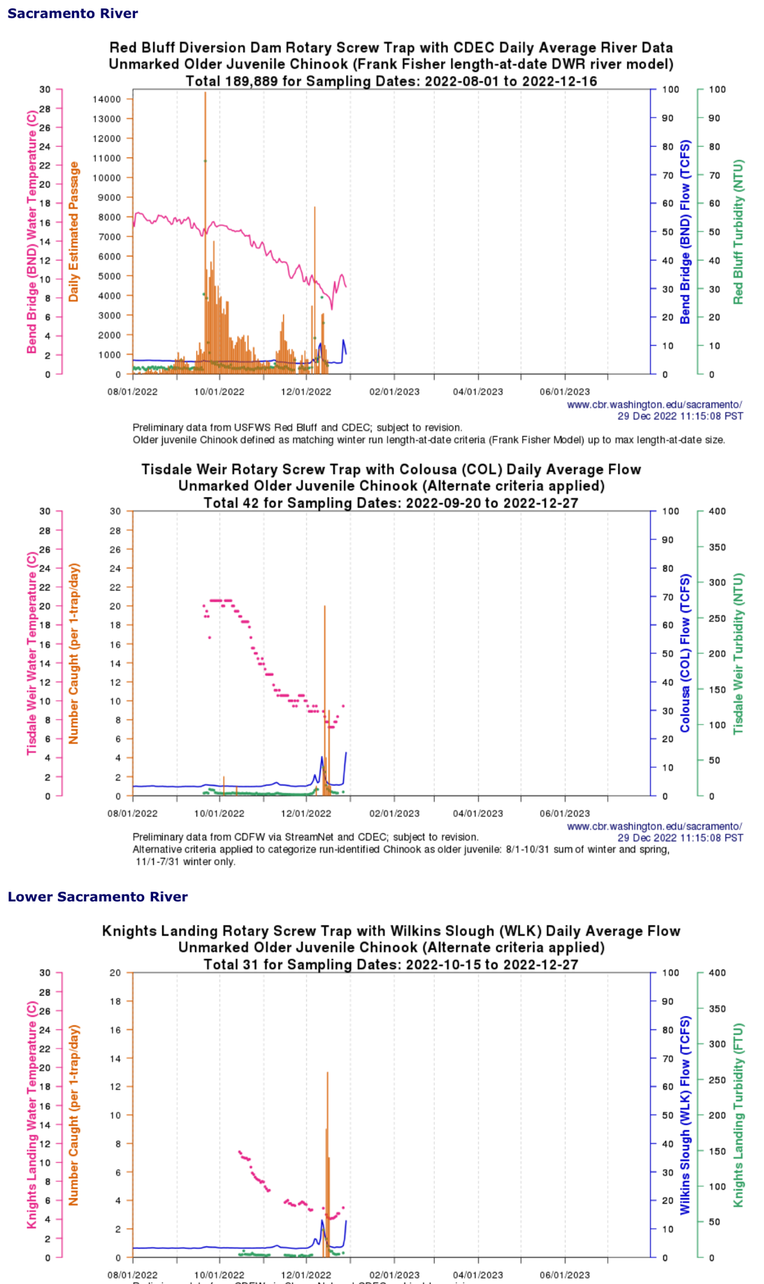
There are 20 million or so fall-run salmon pre-smolts soon to be released this spring from the seven Central Valley salmon hatcheries. Hatchery personnel will release these salmon to the rivers, Delta, Bay, and coast. Where and when they do so will greatly affect how many salmon reach the ocean and return to the rivers to spawn (escapement).
The following measures if adopted will increase success:
- Truck as many smolts as possible to the coast and Golden Gate. Hold as many as these as possible for late spring, summer, and late fall (yearling) release.
- Limit in-Delta and East Bay releases, because to succeed they must occur in early spring when receiving waters are cool. Early spring releases are smaller fish that do not survive as well, especially if they are released near the hatcheries.
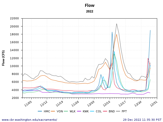
- Coordinate river (near-hatchery) releases in spring with river and Delta inflow/outflow flow pulses and with optimal water temperature and turbidity conditions.
- Appropriately clip all adipose fins, and coded-wire tag all smolts.
- Track and analyze survival under varying release strategies.
- Adopt a Parental-Based-Tagging (PBT) program to support the overall recovery program.
- Fund and implement hatchery program facilities and operational improvements, as recommended and planned by agencies.
Natural Production
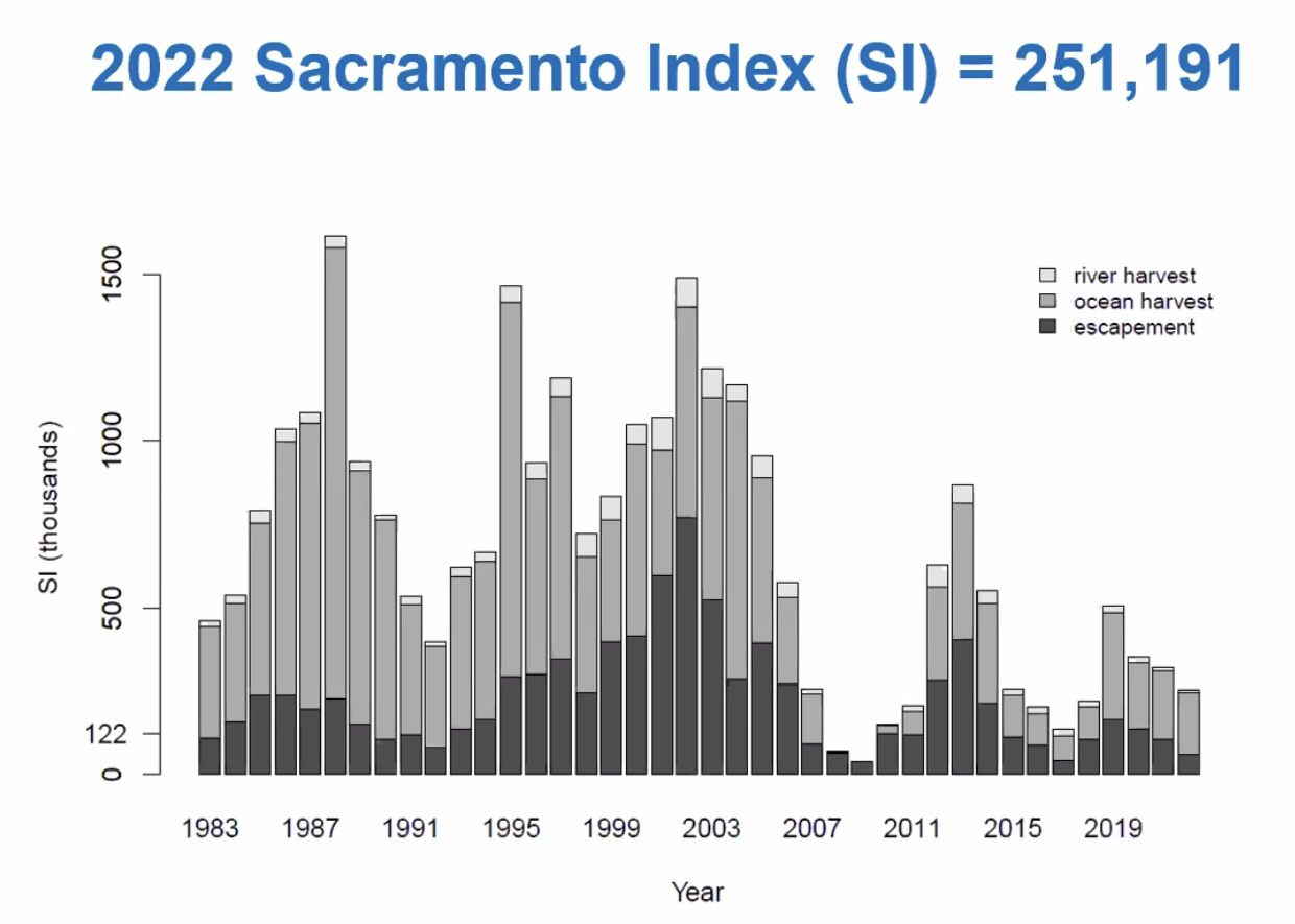
Millions of eggs will be spawned in rivers this fall, despite what may be a near-record-low number of returning adults (escapement) in 2023. It is imperative that the young salmon hatched from these eggs survive and contribute a maximum of natural-born smolts to the ocean. We are so lucky that Mother Nature has provided the necessary water resources this year to allow that to happen.
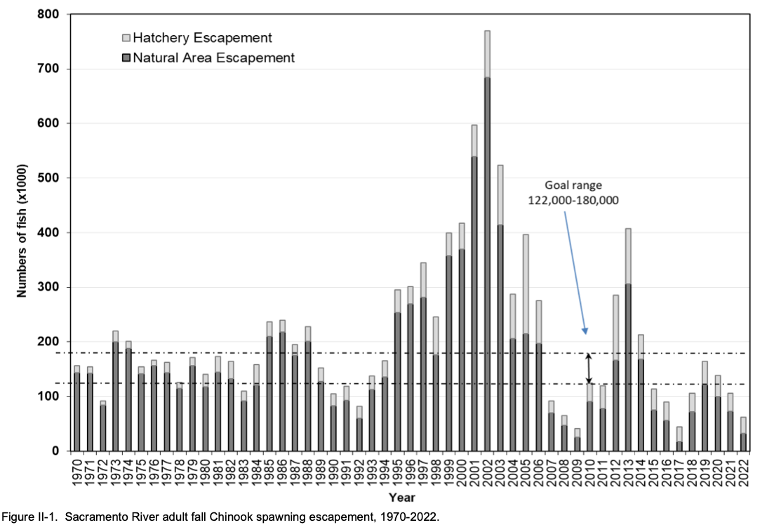
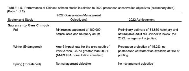
As it is, only 32,000 adult salmon spawned naturally in rivers last fall, compared to 300,000 just a decade ago. The earlier 2010-2016 recovery was a great accomplishment soon after the 2007-2009 population crash, when natural born escapement was only 25,000-70,000 (see Table 1). That recovery was brought about after two years of fisheries closures (2008-2009) and three relatively abundant water years (2010-2012).
The following measures if adopted will increase success:
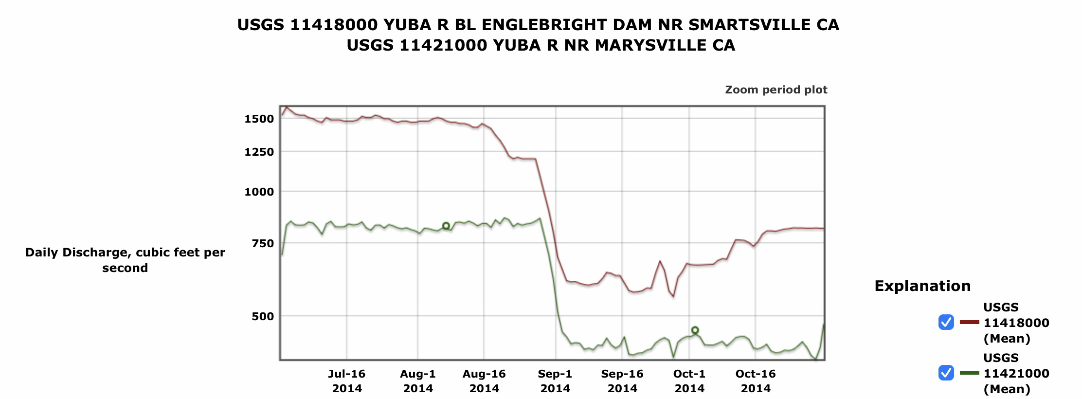
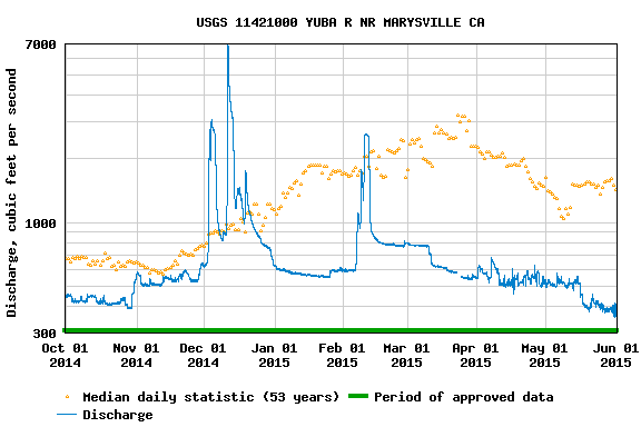
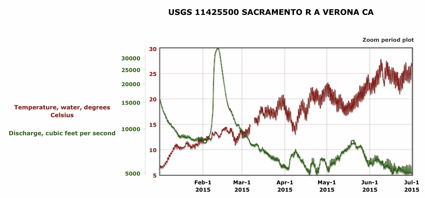
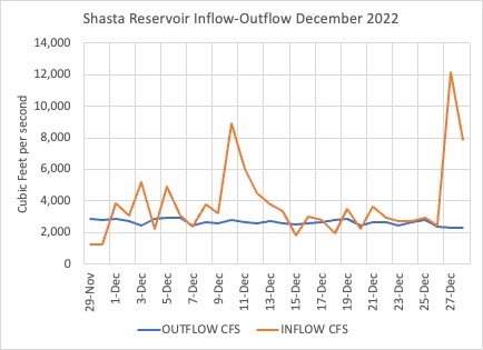
- Provide coordinated spring river flow pulses with storage reservoir releases and/or foregone water diversions (if necessary).
- Maintain minimum flows in rivers to meet or exceed year-round water temperature standards.
- Limit south Delta exports during natural or induced flow pulses, and otherwise follow the export restrictions required in the 2008-2009 Biological Opinion.
- Minimize salmon egg, embryo, and fry stranding in spawning gravel beds (redds) that occur when reservoir releases are reduced after spawning has occurred.
- Minimize stranding, entrainment, or adverse water temperature changes caused by otherwise legal water diversions.
- Limit agricultural or municipal waste water discharges that may increase water temperature in key salmon habitats.
- Upgrade gravel supplies in prime spawning habitats before next fall’s spawning season.
Future Fisheries
In addition to closing fisheries and limiting harvest this year, it will likely be necessary to limit harvest in 2024 and 2025. This is because of the over-harvest in 2021 and 2022 of broodyears 2018 and 2019 (Figure 1), which will likely lead to poor returns from broodyears 2021 and 2022 (Figure 2). Broodyear 2021 is of special concern, because, like broodyear 2020 (whose poor prognosis for 2023 escapement led to the fishery closure), broodyear 2021 reared and out-migrated in a critical drought year (2022).
The following measures if adopted will increase success:
- Plan for a closure in 2024 to protect an expected poor return from broodyear 2021.
- Consider as an option for the 2024 and 2025 seasons a mark-selective fishery if the measures under Hatchery Production outlined above are accomplished and show signs of being effective.
Other recommended actions
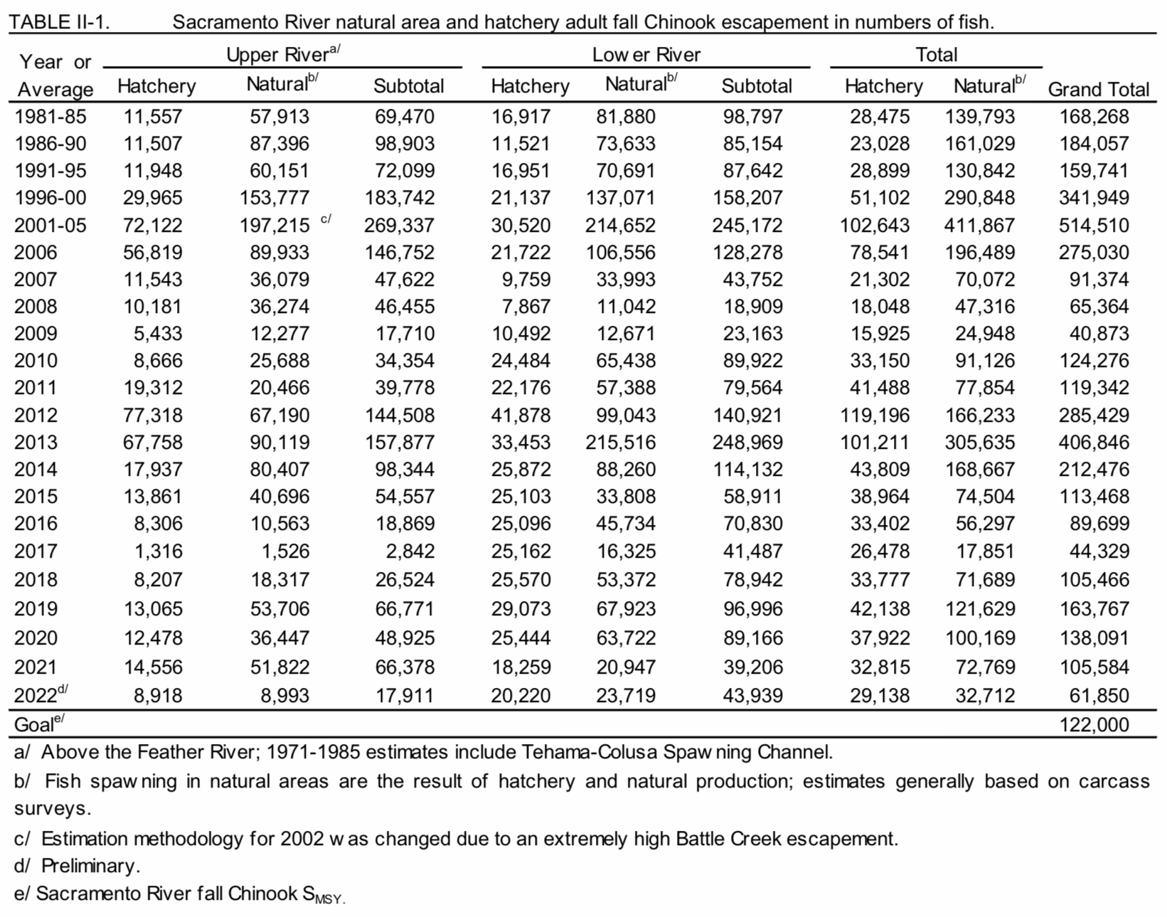
Table 1. Source: PFMC.

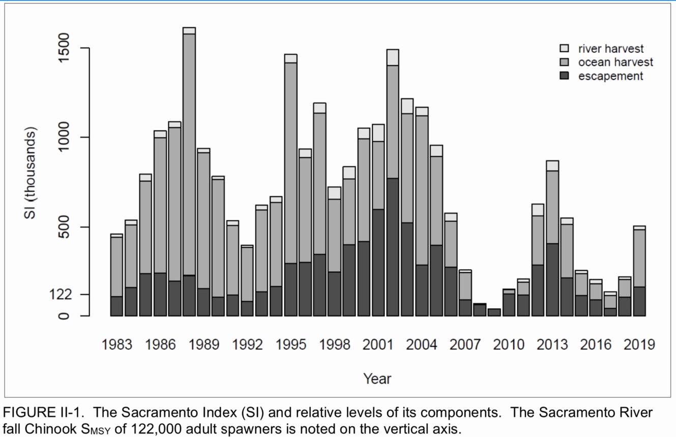
Figure 1. Sacramento River fall-run Chinook salmon population index comprised of escapement (natural areas and hatchery counts) and river and ocean harvests. (Source: PFMC)
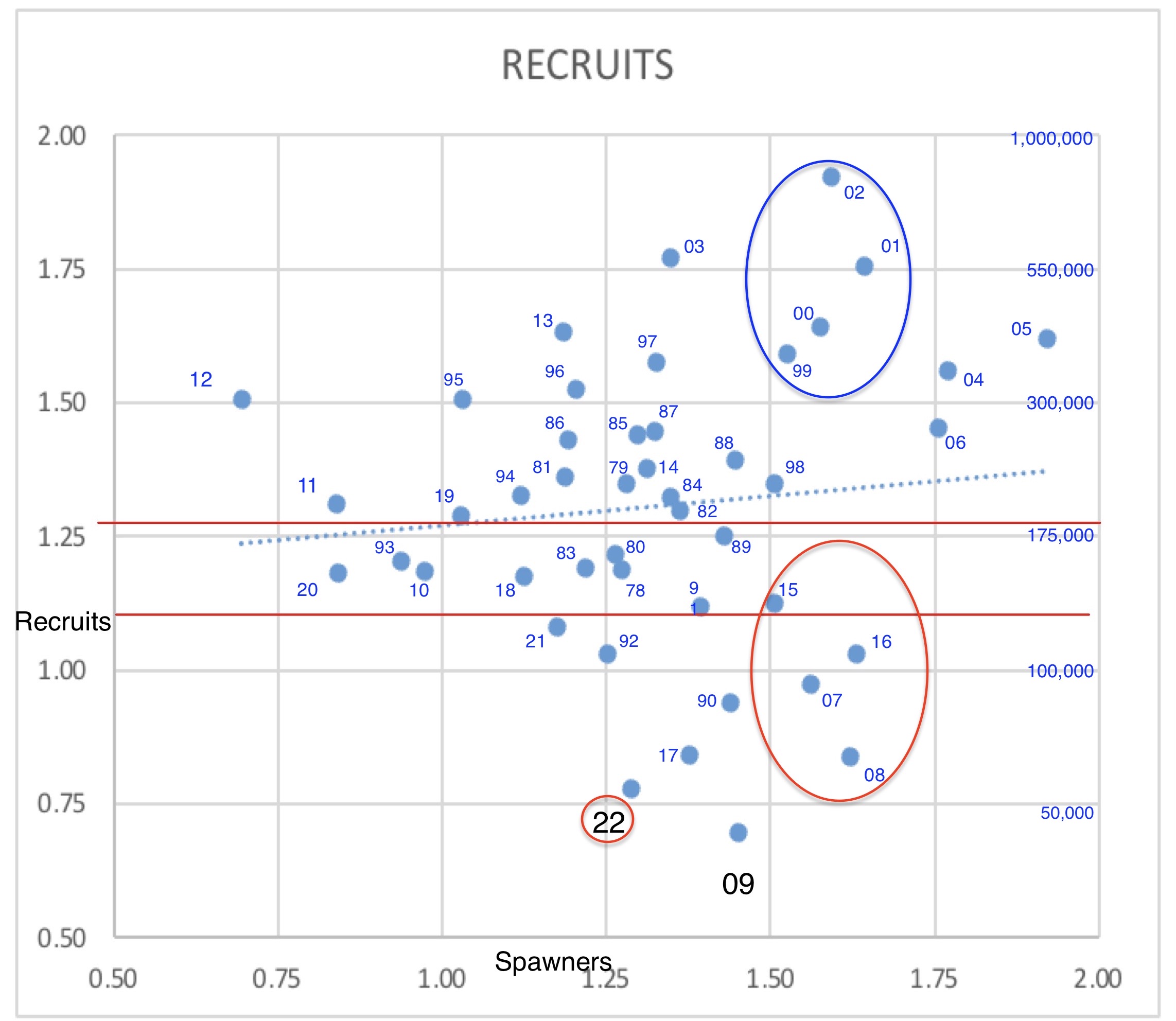
Figure 2. Author-developed spawner-recruit relationship using total escapements in Table 1. Number shown is recruit year escapement (left y-axis is log(x) minus 4 of recruits) plotted against spawner escapement (x-axis, recruitment three years prior). Actual number is shown in log scale on right y-axis. Red lines are target PFMC escapement range for fishery. Red and blue circles show recruitment difference between wet and dry years at maximum sustained yield spawner levels. (Spawner levels of 300-500 thousand levels can yield 500,000 recruits from wet years or as few as 100,000 recruits from dry years). Note poor recruitment in 2021 and even less in dry year 2022 due to over-harvest.