
Juvenile winter-run, spring-run, fall-run, and late-fall-run salmon need a flow boost in the fall and winter to help them emigrate 300 miles down the Sacramento River from their spawning area below Shasta Lake to and through the Bay-Delta.1 Yet while winter storms have now caused massive runoff downstream, the spawning reach of Sacramento River remains at its minimum flow. Even small pulse releases from Shasta and Keswick reservoirs during storms would start hundreds of thousands of juvenile salmon on their way to the ocean.
Historically, more than 50% of salmon spawning in the lower Sacramento River took place downstream of Clear Creek (Figure 1). That distribution has now changed, with over 90% of the spawning upstream of the mouth of Clear Creek in the 20 miles of river downstream of Keswick Dam. This change is a consequence of water management that confines suitable spawning habitat in summer and fall to the uppermost river reach.
Many juvenile salmon begin their migration to the ocean when the first fall rains create a pulse in streamflow. These fish include winter-run and late-fall-run smolts, and fall-run and spring-run fry. The first fall rain-induced flow pulse has been long recognized as an important functional flow event for all four salmon runs. For many decades, the fall pulse was recognized as an important feature needed in salmon management to ensure good survival of smolts to the ocean.
The fall pulse has often been forestalled in recent decades both by droughts and by water management. When the fall pulse comes, it comes only from upper river tributaries. But the natural salmon production cycle in the upper 20 miles of the spawning reach misses out on the flow benefit of fall rains. All runoff is captured in Shasta Reservoir. While downstream reaches receive tributary rainfall-induced streamflow (Figure 2), the upper river receives no pulse from Shasta Reservoir despite significant inflows (Figure 3). This factor alone is a key factor limiting natural production of the four salmon runs in the upper Sacramento River.
Lack of flow from Shasta also limits the effectiveness of the overall flow pulse (Figures 4 and 5) that carries the juvenile salmon downstream to the estuary. The upper Sacramento River, McCloud River, and Pit River flow into Shasta Lake. These major spring-fed rivers are the largest contributors of natural flows to the Sacramento River watershed, especially in drier years. They have not provided any the mainstem streamflow to the Bay-Delta estuary as yet this year. This pattern is generally true in all but the wettest water years.
Shasta Lake gained about 40,000 acre-feet in the first fall storm (Figure 6). A pulse flow of 5000 cfs for three days (an increase of approximately 2000 cfs for 72 hours) would have amounted to approximately 12,000 acre-feet, or roughly 30% of the water gained and (0.8% of the total storage). Considering that much of the first storm fell as snow, water managers could have reasonably have executed such a short pulse..
The second storm has delivered Shasta Reservoir another 100,000+ acre-feet. With a wet forecast for January, it is now time to release a least a short pulse from Shasta to move juvenile salmon downstream to where they can surf the tributary inflow to the Sacramento River downstream to the Delta. It is not too late. Before the storm that began December 29, most of the juvenile salmon remained upstream of Red Bluff or downstream in the river above the Delta,2 as few had shown in Sacramento seines and trawls (data not shown).
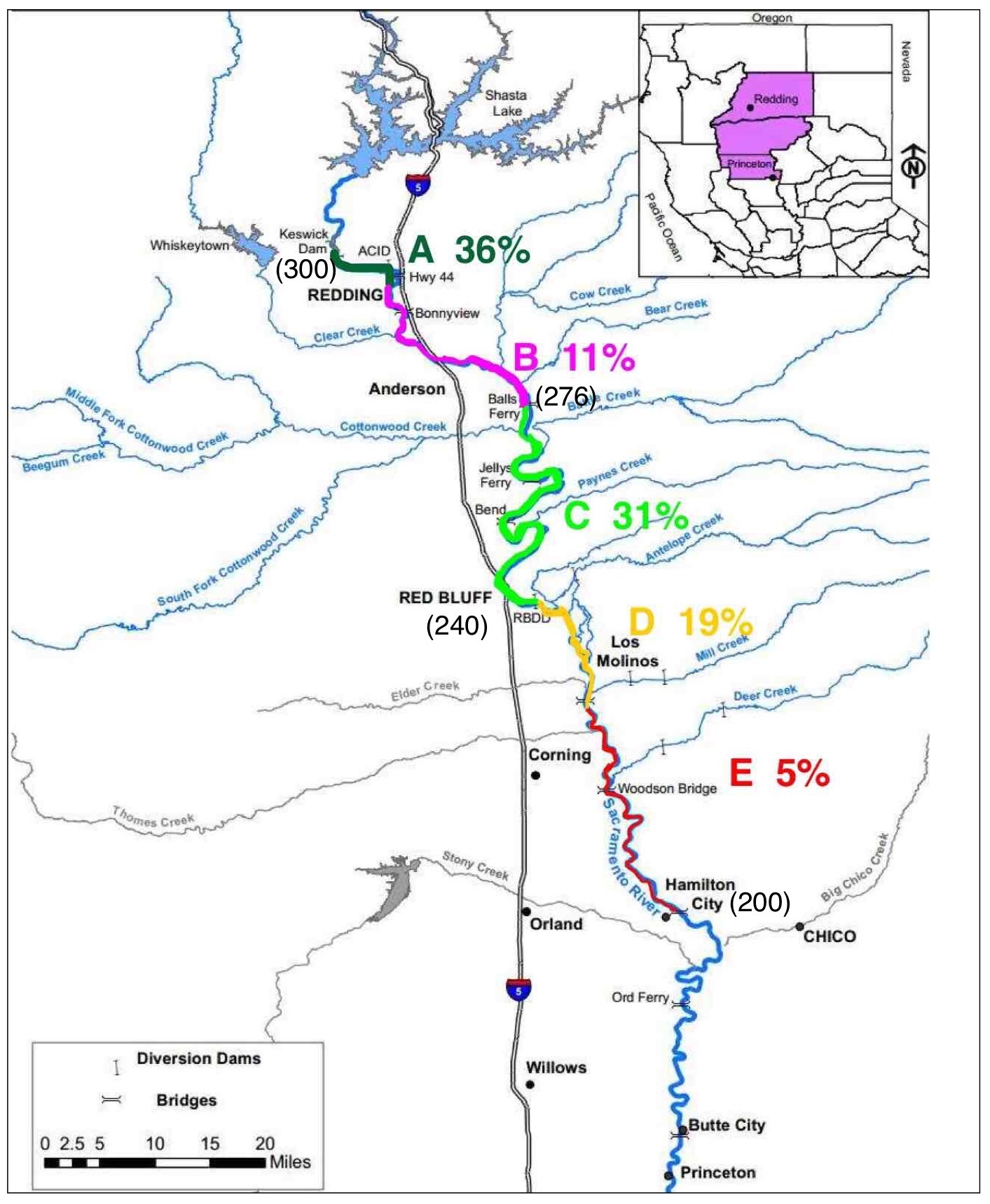
Figure 1. Upper Sacramento River and historic salmon spawning distribution by percent by region. River-mile shown in parentheses. (Data source: CDFW)
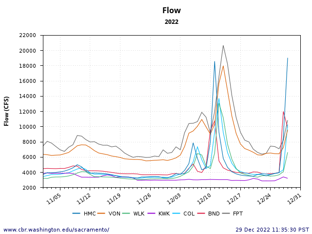
Figure 2. Fall river flows at seven locations from Keswick Dam RM-300 (KWK), Bend RM-250 (BND), Hamilton City RM 200 (HMC), Colusa RM-144 (COL), Wilkins Slough RM-140 (WLK), Verona RM-80 (VON), and Freeport RM-50 (FPT) in the Delta.
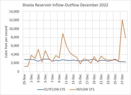
Figure 3. Shasta Reservoir inflow and outflow in December 2022. (Data source: CDEC)
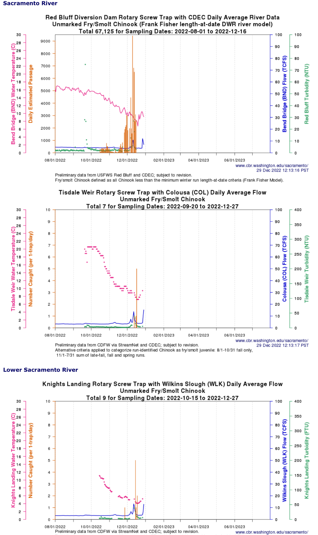
Figure 4. Screw-trap catch of fry spring-run and fall-run salmon with environmental data in fall 2022 at three locations in lower Sacramento River.
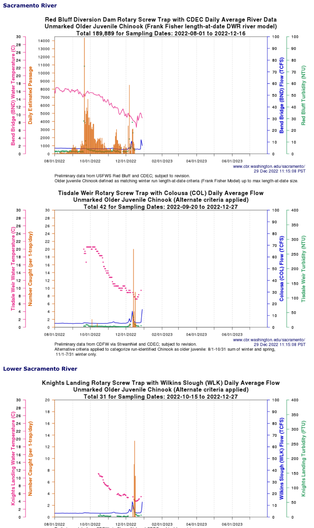
Figure 5. Screw-trap catch of winter-run fry-smolt salmon with environmental data in fall 2022 at three locations in lower Sacramento River.
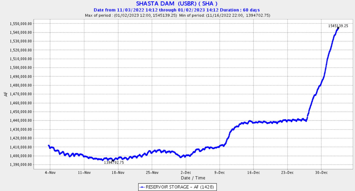
Figure 6. Shasta Reservoir storage level in Nov-Dec 2022.