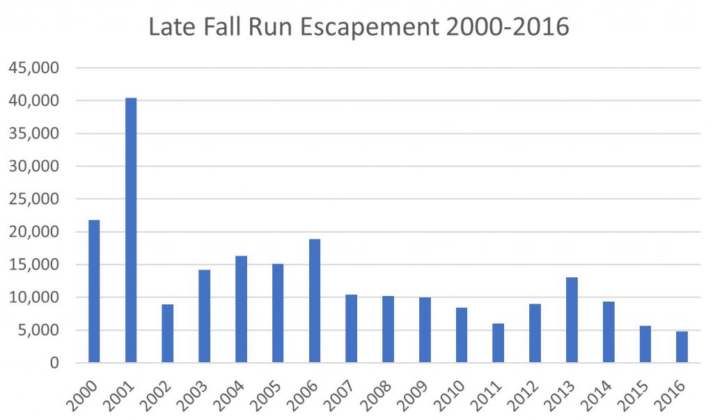
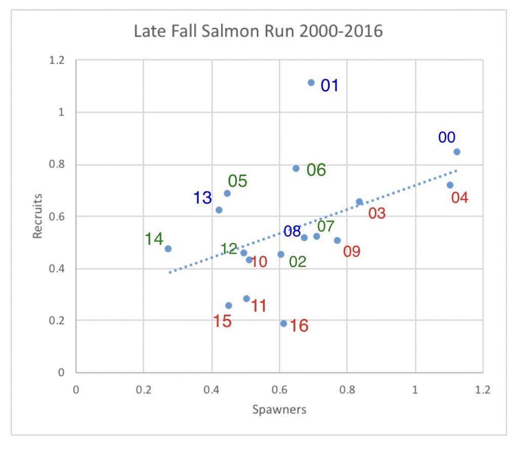
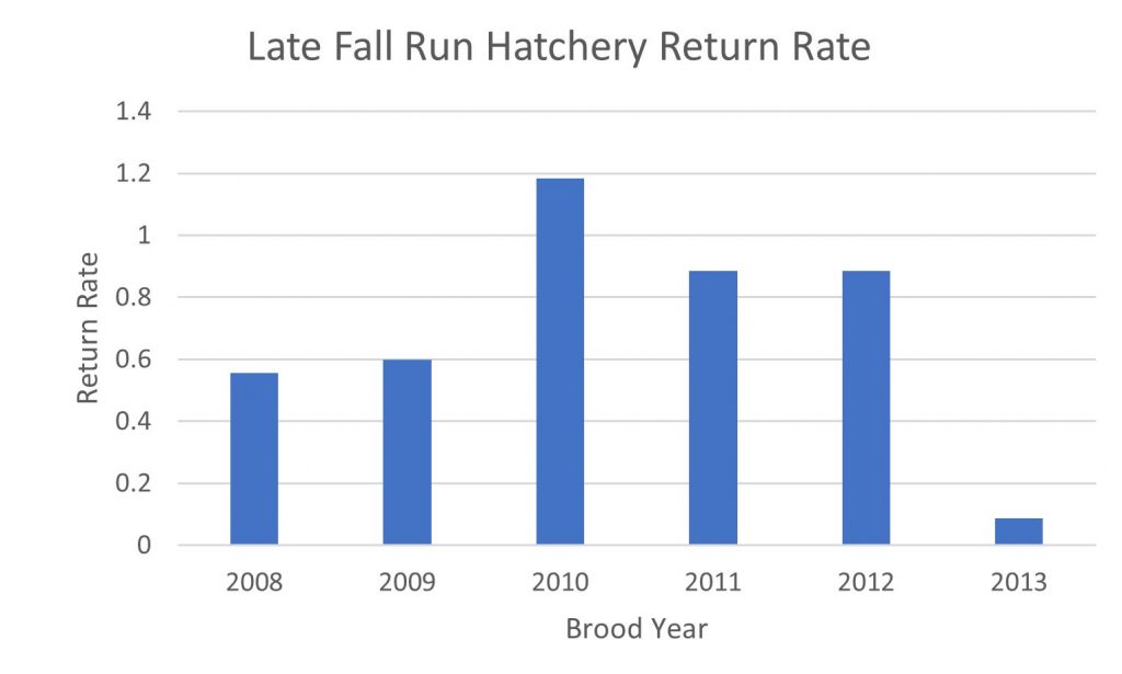
Washington State is increasing salmon production to help in recovery of near extinct salmon populations and orca (killer whales). A Washington state Department of Fish and Wildlife webpage describes the role of hatcheries in restoring wild salmon stocks:
In recent years, state hatcheries also have taken on an equally important role in helping to recover and conserve the state’s naturally-spawning salmon populations. Nearly all the hatcheries in the Columbia River and a number of hatcheries in Puget Sound play a role in wild fish rebuilding programs, whether by rearing juveniles prior to release or holding fish through their lifespan to ensure the survival of depressed stocks. This renewed focus on wild stock recovery represents a major realignment in hatchery operations, as WDFW, the tribes, federal government and independent scientists worked to develop a comprehensive operations strategy for hatcheries in Washington. 1
The main reform actions being taken in Washington’s program are:
- Marking all hatchery salmon smolts allows identifying hatchery fish by hatchery and lot group. It also allows mark-selective fisheries that require release of wild salmon.
- Developing salmon population-specific recommendations intended to provide scientific guidance for managing each hatchery more effectively in the future.
- Keeping hatchery program budgets in pace with increasing operating costs (especially utilities, fish feed and labor costs), and not forcing cutbacks in some programs.
- Updating aging hatchery infrastructure.
- Supplementing wild stocks: to maximize egg fertilization and fry survival (of wild) and thereby increase the number of “wild-type” smolts heading out to the ocean.
- Maintaining captive broodstocks of endangered stocks with dangerously low population levels: juveniles are maintained in a hatchery for their entire life to ensure the stock’s survival.
- Minimizing interaction between naturally-produced and hatchery-produced outmigrating juveniles and adult fish returning to streams to spawn where necessary.
- Donating surplus adult salmon from hatcheries to non-profit hunger-relief programs.
- Introducing hatchery carcasses or analogs back to streams to increase natural productivity to low productivity streams.
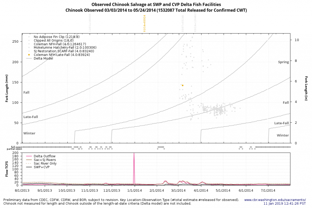
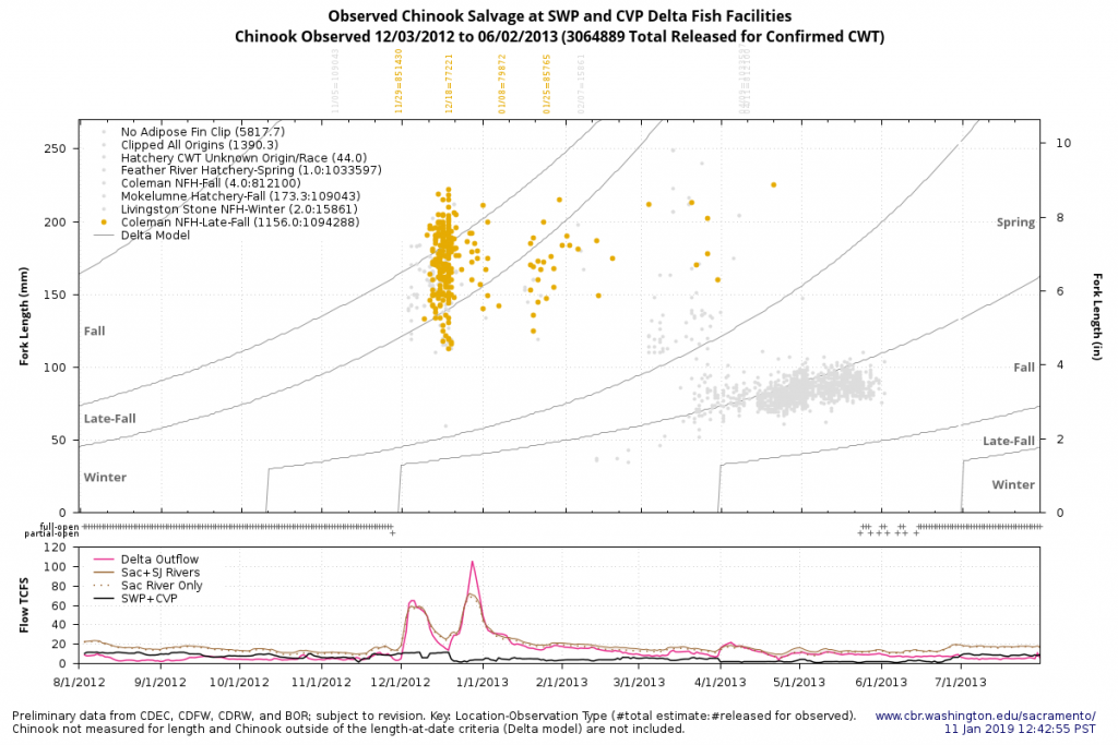
While California is slowly moving toward some of these reforms, there is resistance to others. For more information and links on California hatchery programs see http://calsport.org/fisheriesblog/?cat=5 , https://www.wildlife.ca.gov/fishing/hatcheries , http://cahatcheryreview.com , https://www.fws.gov/sfbaydelta/Fisheries/hatcheries/NoCAHatcheriesUSFWS.htm .